
Prokoško Lake: Shepherd Huts High Above Fojnica
Prokoško on Vranica at 1,636 m: katuni, gate prices for foreigners, no swimming, and the 2026 asphalt climb from Fojnica.
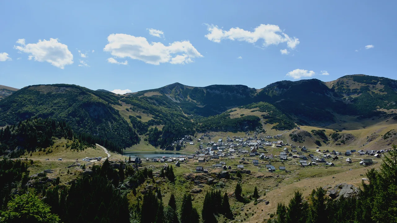
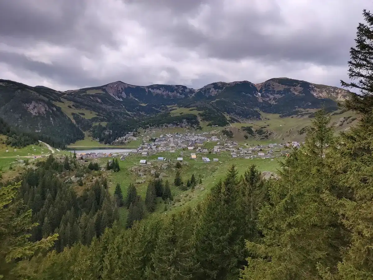
Prokoško Lake sits at 1,636 m on Vranica, about 22 km above Fojnica, as a glacial “mountain eye” ringed by wooden shepherd huts. You come for the altitude and the katuni, not for a swim - the managers ban bathing outright - and you pay at the gate in convertible marks. In clear summer weather an ordinary car can now finish the climb on asphalt finished in late July 2026; snow, ice and the narrow last kilometres still decide whether that hire sedan is a good idea.
The postcard sells water. The day you actually get is a high pasture, cheese and coffee in a hut, a shore walk, and a hard rule about staying dry.
What the mountain eye is for
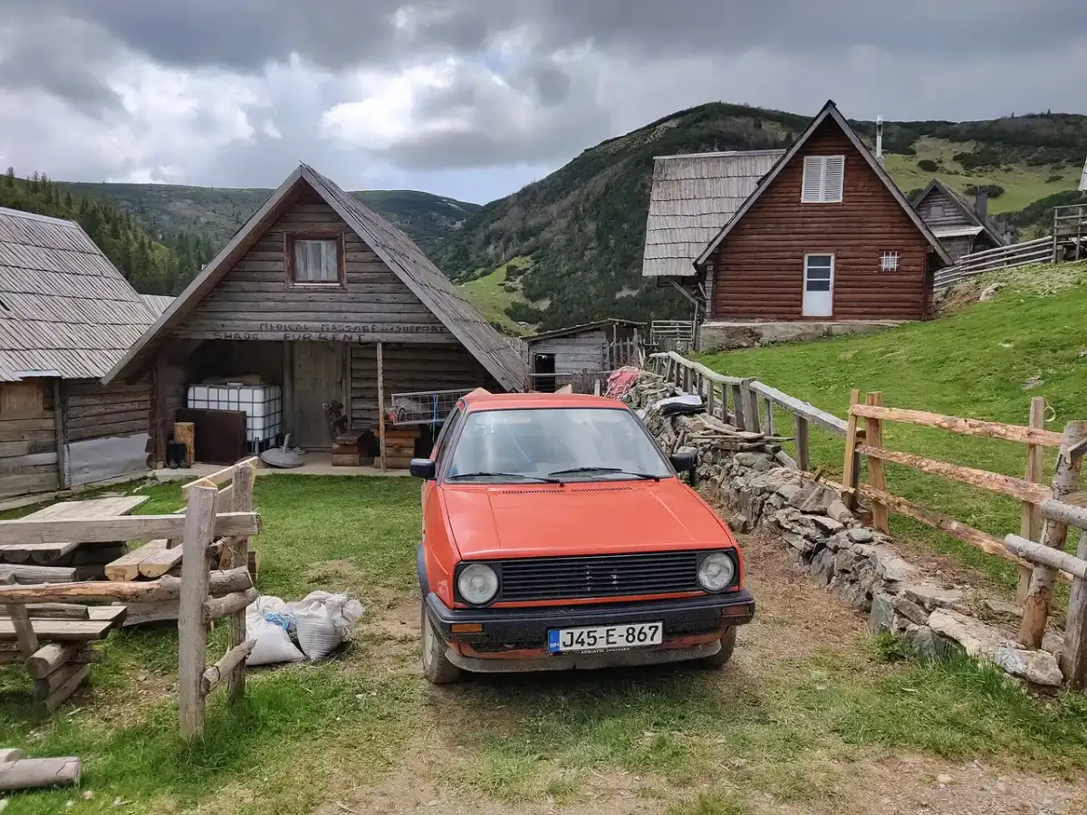
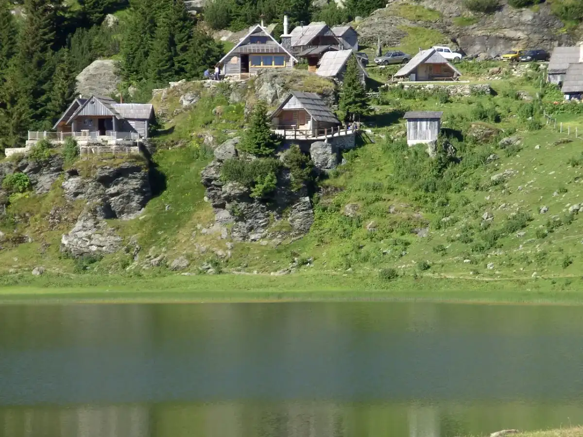
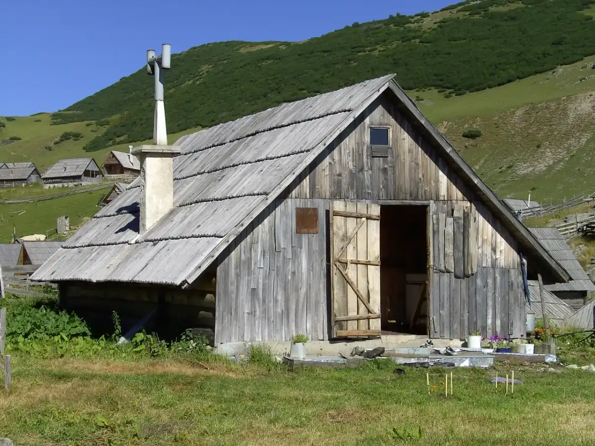
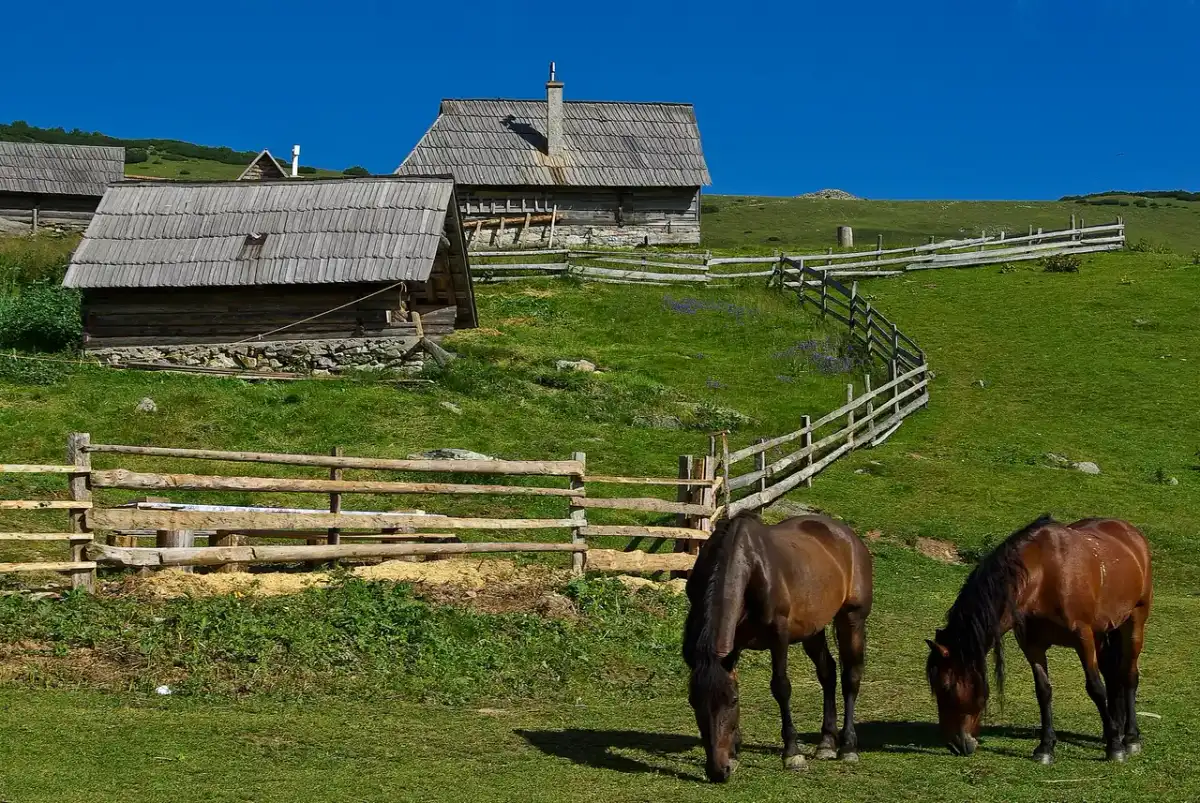
Prokoško is a protected nature monument under temporary management by JKP “Šćona” d.o.o. Fojnica. The official site puts the basin at 1,636 m and 22 km from Fojnica. A few lines further down, that same page calls the road 21 km. Round it to “about 22 km” and don’t hang your timings on the last kilometre. The wooden katuni on the slopes are still the reason people drive up: working mountain architecture, not a staged village.
Bring layers even in July. At this height the wind cuts through a T-shirt the moment the sun ducks behind a ridge, and the light shifts fast. Plan a slow loop of the shore, not a rushed photo stop: the value is the air and the hush between huts, not ticking another lake pin on a map. Stay long enough to watch cloud shadows cross the water - twenty minutes feels thin once you’ve paid the gate. For how Prokoško sits next to swim-friendly basins, the best lakes in Bosnia page sorts warm water from look-only water without pretending every blue shape is a beach.
The 2026 road: asphalt yes, promises no
For years the last stretch was gravel lore - high-clearance advice, 4x4 talk, “don’t take the city car”. That story is half outdated. Fojnica municipality, announcing the finished works itself, puts the job at 16 km of new asphalt: 11 km of regional road R-438 with a 4 m carriageway, then the local section from Vlaška ravan up to the lake, 5 km long and only 3 m wide. Traffic started running on the finished surface from 30 July 2026, and vehicles of all categories can now reach the protected area on paved road.
Read that width again before you picture a comfortable mountain drive. Three metres is one car plus elbows: on the last 5 km, two vehicles meeting have to work out between them who reverses to a wider spot. Nobody is coming to referee that at 1,600 m.
That is not a blank cheque for every hire contract. Clear summer daytime is when an ordinary sedan is realistic. Night fog, early snow, ice and a timid rental policy on mountain roads can still strand you. Don’t treat “asphalt exists” as “the road is always open” - at 1,636 m winter is a different season, and the manager publishes no opening hours you could plan a day around. If you’re collecting high pastures on foot as well as by car, hiking in Bosnia covers longer Vranica and Via Dinarica context without turning this lake into a trailhead essay.
Draw cash in KM before you leave Fojnica. Card machines at a mountain gate are a hope, not a plan.
Gate prices (July 2026 board)
The manager published a service board on the nature-monument site (image dated with the page on 10 July 2026). Foreign visitors pay more than BiH residents. Numbers below are from that board - confirm at the barrier, because temporary management can revise a tariff without rewriting every travel blog.
| Service | BiH citizens | Foreign visitors |
|---|---|---|
| Adult entry | 3 KM | 6 KM |
| Car parking inside the complex | 15 KM | 20 KM |
| Parking before the gate | 10 KM | 15 KM |
| Camping (tent or camper) | 20 KM | 30 KM |
| Pupils/students (group) / age 70+ | 2 KM | 2 KM |
| Herders / disability over 50% (with papers) | free | free |
A foreign pair in one car parked inside is roughly 20 + 6 + 6 = 32 KM before coffee or camping. Quads and motorcycles sit on a flat 20 KM parking line for everyone. Leaving the car before the gate saves a little parking money and adds a walk - useful when the inner lot is full on a sunny Saturday.
Rules people ignore (and shouldn’t)
The managers’ own Q&A page is blunt: swimming, bathing and any similar entry into the lake are strictly forbidden. That isn’t a soft “cold water warning”. It’s a protection rule. Pack the swimsuit for Boračko or Pliva on another day; here you walk the shore and keep your feet dry.
Other catches from that same page:
- No open fires or grills on the alluvial plain inside the stone fence without ranger approval.
- No renting tents or umbrellas on that fenced grass; personal umbrellas for a short sit are the limited exception they describe.
- Camping is allowed, but you organise it with the rangers at the gate and you take your rubbish out.
- Motorbikes and quads may enter if they pay and behave - no tearing through the katun settlement, no parking that blocks the road, and no riding behind the stone fence onto the plain.
Cameras have their own procedure, and it isn’t a formality. The Q&A asks everyone arriving to tell the project manager and the ranger service what they’ve come to do. For filming and photography specifically the managers offer two routes: you pay for the right to shoot, or you agree that they may use your material freely with you credited as the author. Phone snapshots of your own day are ordinary visitor behaviour; turning up with a kit bag and a shot list is a conversation to have at the gate, not after.
One detail the guidebooks still get wrong: the endemic alpine newt, Ichthyosaura alpestris reiseri, no longer lives in the lake. Adnan Zimić, the National Museum of BiH curator running the conservation work here with the same site manager, says plainly that the newt is gone from the water and survives in a handful of small pools around the basin - the lake itself now holds over five tonnes of fish. The subspecies belongs to this place historically, and the bathing ban stands on the managers’ own protection rule. Treat the basin as a lookout, not a pool.
Shaping the day from Sarajevo
Most visitors overnight in Sarajevo and treat Prokoško as a full mountain day, not a quick add-on. Drive to Fojnica first (roughly an hour-class run west of the capital in clear traffic), fuel up, take cash, then climb the 22 km to the lake. In summer light you’ll want most of a day: gate, shore loop, lunch in a hut, slow descent before dusk. Trying to squeeze this after a morning in Baščaršija usually means you arrive tired and leave early. A midweek morning is quieter than a sunny Saturday when valley day-trippers pile up at the barrier.
Overnight near the lake is possible where camping is organised through the rangers, or you drop back to Fojnica for a simple room. Either way, check weather the night before - a clear forecast at valley level can still mean cloud sitting on Vranica by noon.
If you’re building a wider loop from the capital, day trips from Sarajevo maps the classic out-and-backs; Prokoško belongs with the high, slow ones, not with a waterfall sprint.
When the climb is worth it
Go when you want altitude and timber huts more than a swim, when the summer forecast is clear, and when you’re happy to budget about 32 KM for two foreigners and a car before food. Skip it when the mountain is in cloud, when you’d rather be in the water, or when your hire agreement and the forecast both look nervous about a narrow 1,600 m road.
Boračko and Pliva still win for swimming. Prokoško wins for the katun skyline and the feeling that you’ve left the valley behind. Treat the July 2026 asphalt as a real improvement - and still drive the last kilometres like the mountain road they remain.
Photos
On the map
The map loads on click - to keep the page lightweight.
The map didn’t load. Check your connection and refresh the page.
Admission and opening hours
- Admission price
- Foreign visitors: adult entry 6 KM + car parking 20 KM inside the complex (or 15 KM if you leave the car before the gate). BiH citizens: 3 KM entry + 15 KM parking inside. Camping 20 KM (BiH) / 30 KM (foreign). Cash in convertible marks at the gate. Prices from the manager board dated July 2026 - confirm on arrival.
- Opening hours
- The manager publishes no opening hours at all - there is no posted timetable for the gate on the official site. The basin sits at 1,636 m and snow can close the climb outside summer, so ask locally in Fojnica about conditions and staffing before you drive up.
Swimming and any entry into the lake are strictly banned by the nature-monument managers. The asphalt road from Fojnica was completed in late July 2026, but the last kilometres are narrow and winter conditions still stop ordinary hire cars.
Details checked: September 3, 2026
Distance ≈80 km · about 1.5-2 h by car via Fojnica in clear summer weather
- Sarajevo ≈80 km · about 1.5-2 h by car via Fojnica in clear summer weather Routing estimate, not an operator figure: roughly 80 km all in - Sarajevo to Fojnica, then the mountain climb the manager puts at about 22 km. Allow extra time for the narrow final section and for paying at the gate.
Read also

What to see · 15 min read
Via Dinarica Bosnia: Huts, Stages & Logistics
Verified · September 12, 2026Plan the Via Dinarica White Trail in Bosnia: 12 stages, 334 km, hut booking, trailheads, closures and three workable section packages.

What to see · 10 min read
Jablanica: Neretva Bridge & Roast Lamb Stop
Verified · September 4, 2026Jablanica on the Sarajevo-Mostar road: Battle for the Wounded museum (5 KM), the 1943 bridge, roast lamb lunch. Hours, parking, how long to stop.

What to see · 11 min read
Franz Ferdinand's Sarajevo: Latin Bridge & 1914 Site
Verified · August 29, 2026The Latin Bridge corner in Sarajevo where Franz Ferdinand was shot in 1914: what happened, the Museum of Sarajevo 1878-1918 inside, hours and tickets.

What to see · 10 min read
Vijećnica: Sarajevo City Hall & Its Burned Library
Verified · August 28, 2026Sarajevo City Hall (Vijećnica): the 1896 pseudo-Moorish landmark, the 1992 library fire, the 2014 restoration, plus hours, tickets and what to see inside.