
Hiking in Bosnia: Via Dinarica & the Best Trails
Hiking in Bosnia: the 334 km Via Dinarica White Trail, Bjelašnica and the Rakitnica rim, Cvrsnica, Prenj and Zelengora, plus the landmine rule.
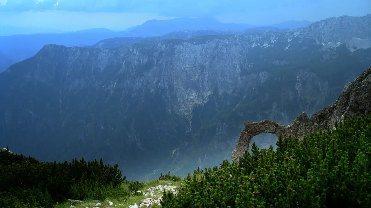
Hiking in Bosnia comes in two shapes. There’s the Via Dinarica White Trail, a waymarked long-distance route that crosses the country in 12 stages and 334 km, and there are four or five massifs you can take one day at a time: Bjelašnica above the Rakitnica canyon, Čvrsnica and its rock arch, Prenj, Zelengora. The season that works up high is roughly June to September. And there’s a rule here that has nothing to do with how fit you are: stay on the marked path, because the countryside still holds landmines from the 1992 to 1995 war.
Travellers tend to either panic about that or wave it away, and both reactions produce a worse trip. Part of the contaminated ground is mapped, but the wartime records those maps were built from are incomplete, so the absence of a warning sign, or of a shaded polygon on a map, is not the same thing as cleared land. The habit that keeps you clear of all of it takes about five seconds to learn.
The landmine section below reflects UK government advice, BHMAC figures and Via Dinarica route information as of July 2026. It is background rather than official safety advice - check the live FCDO page and the current BHMAC data before you walk, and follow the signs and local instructions you meet on the ground.
The rule that makes Bosnia different from the Alps
BHMAC, the state mine action centre, put the ground still contaminated at more than 820 km², about 1.6% of the country, in figures released in 2025. Against the 4,180 km² identified after the war and the roughly 3,360 km² cleared since, that’s progress measured in decades: the revised 2025-2027 strategy targets 75 km² a year. Which is another way of saying the contamination will not be gone by the time you visit.
Those numbers are estimates rather than an inventory, and it matters that you read them that way. Mine Action Review states flatly that Bosnia “still lacks a reliable estimate of anti-personnel mined area”, and the official product BHMAC publishes is a map of mine suspected areas - suspected, not surveyed and confirmed. Plenty of mines were laid without any record being made at all.
The UK Foreign Office puts the practical version plainly. Landmines and unexploded weapons “remain from the 1992 to 1995 war”, and the sentence that follows is usually quoted at half length. In full: “While highly populated areas and major routes are largely clear, there is still a risk in less populated and rural areas.” Less populated and rural is where hiking happens. The instruction attached to it’s “do not step off roads and paved areas without an experienced guide.” The ground it flags is exactly the ground a walker drifts onto without thinking: road edges, open countryside, untarred side roads, woods and orchards, neglected land, and abandoned buildings.
So the habit is small and absolute. No shortcut across a meadow, no cutting the corner off a switchback, no stepping wide for a better photo angle, no ducking into a ruin for shade, no pitching a tent on unmarked ground. Follow the paint.
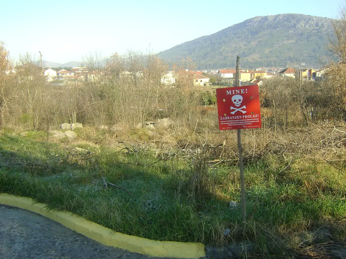
Put the free BHMAC app on your phone before you leave signal. It’s called “BH Mine Suspected Areas” (Android; the iOS app was pulled from the App Store - on iPhone use EUFOR’s BHMAC minefield maps), and every word of that name is doing work: it shows where contamination is suspected, not a complete inventory of where mines are. Guides here open it in the field rather than treating it as a formality. The Via Dinarica trail portal works the same way, reporting mine status stage by stage rather than declaring the route clear: the Umoljani to Lukomir page, for instance, states that “the trail is not technically demanding and there is no danger from mines.” Read the page for the stage you’re walking, because that sentence covers one stage and nothing else.
The zoning gets startlingly specific, and it is worth seeing how it’s worded. The English-language description of Visočica says the mine risk is “minimal” in the area west of the Crveni Kuk summit and northeast of a line drawn between the villages of Luka and Grušća. Minimal risk isn’t the same as safe, and a paragraph on a mountain page is not a clearance certificate. What it does tell you is that mountains in this country are still described in terms of where the front line ran. Our full safety guide to Bosnia covers the wider picture, and it is worth checking whether your travel insurance counts mountain walking as an adventure activity needing an add-on.
The Via Dinarica White Trail, in numbers
The White Trail is the mountain strand of a three-branch route along the Dinaric Alps, and the Bosnian section is its centrepiece. The official figures: 12 stages, 334 km, about 120 hours of walking, 18,723 m of ascent and nearly as much descent. High point Vilinac at 2,118 m, low point Jablanica at 200 m, which tells you how much of the effort goes up and down rather than along.
A stage is not a day. The portal is explicit that stages are mountain or geographic regions rather than daily sections, which is why “12” sounds friendly and “120 hours” doesn’t. Shelters and huts fall at roughly every 6 to 8 hours of walking, and where they don’t, the network leans on rooms in village households. Most steep sections have a gentler alternative along a forest road, so a hard stage can often be softened instead of skipped.
The official advice attached to the route is unfashionably direct, and it repeats for a reason: don’t go into these mountains alone, expect sudden weather changes, always leave your route with someone. Mountain rescue is reached through the civil protection operations centre on 121, which coordinates the GSS volunteer teams. For everyday emergencies use 122 (police), 123 (fire) and 124 (ambulance) - Bosnia’s EU-style 112 system is not fully rolled out, so don’t rely on 112 alone.
Almost nobody who comes for a week walks the whole thing. You’ll pick a massif, and these are the four worth picking. For hut booking, trailhead logistics and three workable section packages, see our Via Dinarica through Bosnia guide.
Bjelašnica and the Rakitnica rim: the one to do first
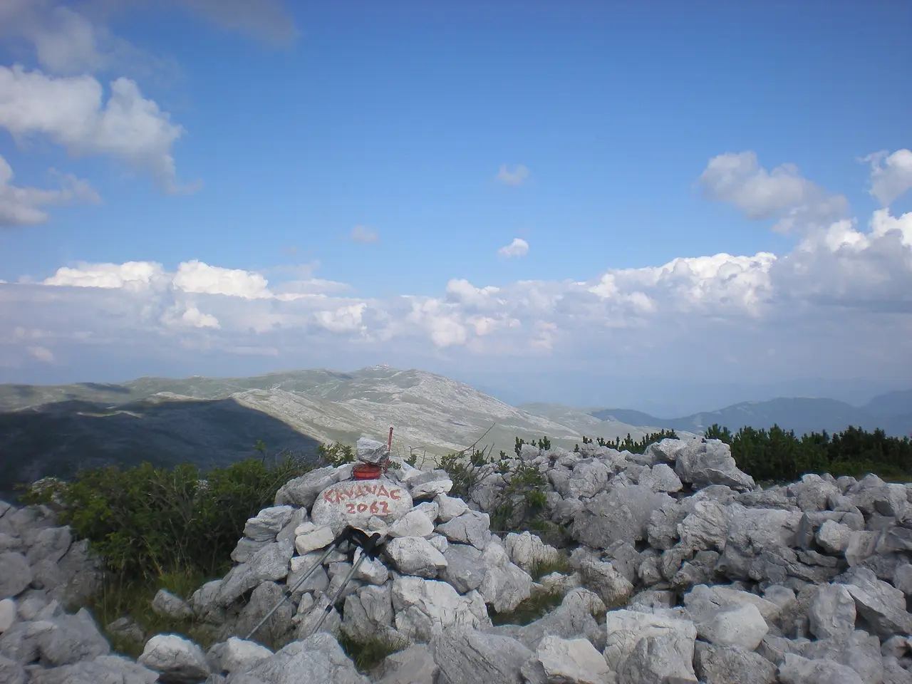
Bjelašnica reaches 2,067 m and starts within an hour of central Sarajevo, and that’s a ridiculous piece of luck for a capital city. Closer still, the Skakavac waterfall loop above Nahorevo is an easy half-day forest walk to a 98-metre drop - no alpine exposure, no gravel road - and we cover the trail in our Skakavac waterfall hike guide. The 1984 Olympic pistes run down the eastern slope above Babin Do and the observatory stands on the summit itself, where a weather station has been recording since 1878. The walking is on the south side, out across a bare plateau of shepherd villages, stone huts and haystacks. The village you want is Umoljani, about 40 km and an hour from the city, the last 11 km of it gravel - not the ski centre, which is nearer and wrong.
The trail to take is Umoljani to Lukomir. Via Dinarica measures it at 15.1 km round trip, 5 hours 12 minutes, 782 m of ascent, high point 1,866 m, starting and finishing in Umoljani at 1,280 m, where you park in front of the mountain hut-restaurant. You climb the ridge to Lukomir, the highest permanently inhabited village in the country, then return on the path along the rim of the Rakitnica canyon, which runs 26 km and drops as much as 800 m, and is squeezed to barely a metre wide in places at the bottom. That return leg is almost flat, so the day gets easier exactly when you want it to. We’ve got a full guide to Lukomir village if the village itself is the goal, and the Olympic mountains day loop if you’d rather drive the highlights.
For the serious version, stage BH-W-08 climbs from the Neretva through the Rakitnica canyon to Lukomir: 32.5 km, 10 hours, 2,203 m of ascent, rated difficult. Its route notes carry two details that say more about hiking here than any brochure. Water comes mainly from wells, so a filter is recommended. And watch where you put your hands and where you sit down in long grass, because of snakes.
Čvrsnica, Blidinje and the rock arch
Čvrsnica rises over the Blidinje plateau in Herzegovina, tops out at Pločno, 2,228 m, and holds the most photographed object in Bosnian hiking: Hajdučka vrata, a natural rock arch at roughly 2,000 m, protected as a geomorphological monument since 1985. The picture at the top of this page is taken from beside it, looking across the Diva Grabovica canyon towards Prenj.
The park’s own route starts at Vitlenica (1,470 m) and runs 16.5 km there and back, about 7 hours in total or roughly 4 hours to the arch, with about 700 m of ascent. The last 3.5 km of access is dirt road that turns rough after heavy rain. The path is well marked, with blazes painted to be followed after dark as well as in daylight. That’s the catch: the nearest drinking water is at the Vilinac hut, a further 40 minutes on, and the Crvenjak lake at 2,000 m that you pass is scenery, not a supply. You’ll want to carry more than instinct suggests. These are limestone mountains and they drain themselves. One request from the park worth honouring: don’t stand directly underneath the arch. It’s fragile, posing visitors have already damaged it, and the park asks for photographs from a few metres in front, which is the better composition anyway.
Prenj, the one they call the Bosnian Himalayas
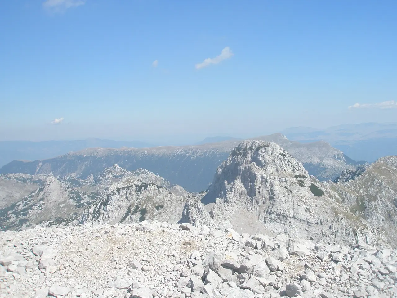
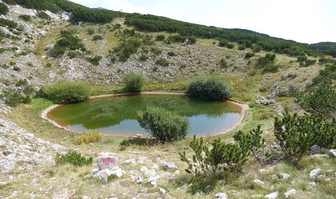
Prenj stands over the Neretva between Konjic and Mostar, about 120 km southwest of Sarajevo, and it earns the nickname by looking the part: grey towers, no tree cover on the tops, no water anywhere. The highest peak is Zelena glava, 2,155 m.
This is the massif where a guide earns their money. Navigation turns hard the moment cloud comes in, the karst holds nothing to drink, and the approach valleys sat on the front line. If you’ve one hard day in your legs and someone local to walk it with, make it this one. If you’re self-guiding a first visit to Bosnia, leave it for the next trip.
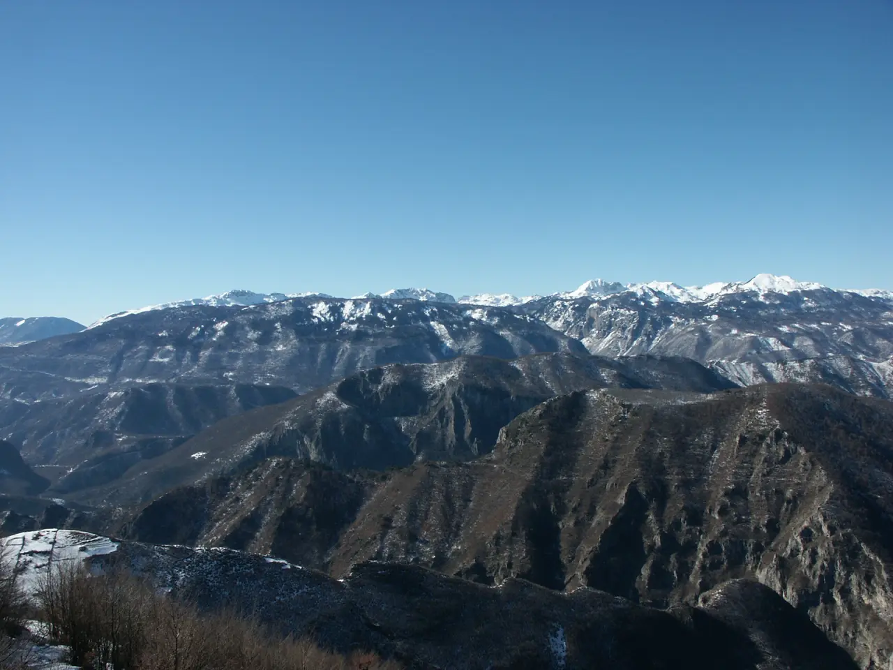
Zelengora, Maglić and the far southeast
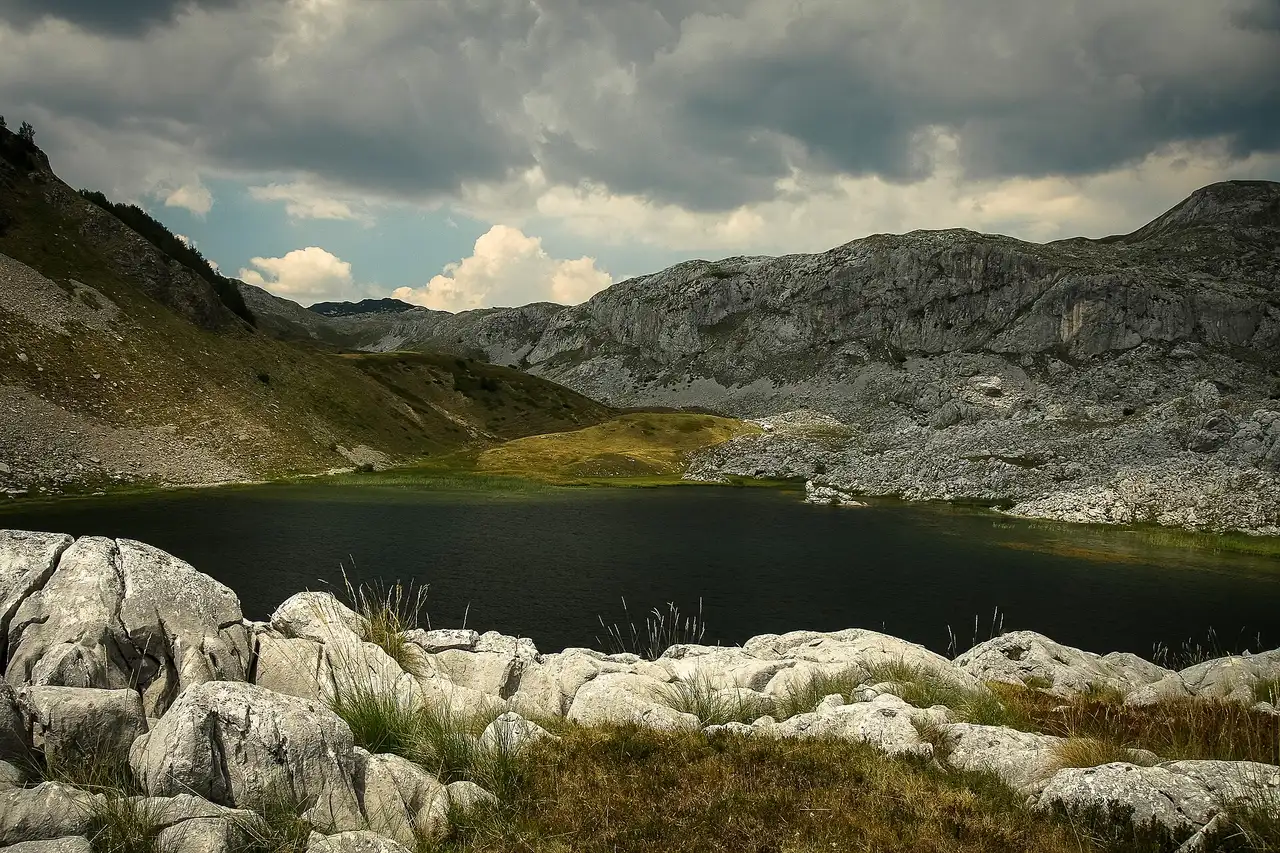
Sutjeska National Park sits at the other end of the country and the other end of the commitment scale. Maglić, at 2,386 m, is the highest mountain in Bosnia and Herzegovina and finishes as a chained scramble; Zelengora next door is a broad grassy massif dotted with glacial tarns and long, gentle ridge days. It’s three hours or more from Sarajevo with no public transport to the trailheads, so it needs its own night or two. Our Sutjeska National Park guide has the detail, including the Perućica primeval forest, which you can only enter with a park guide.
Season, kit and getting to the trailhead
June to September is the realistic window for anything above about 1,500 m. The trail portal lists April to October, which is fair for the low stages and the forest-road variants, but snow lingers on the north faces of Prenj, Čvrsnica and Maglić well into early summer, and storms build fast over the open plateaus on July and August afternoons. Our guide to the best time to visit Bosnia sets out the wider calendar.
A kit list shaped by this country rather than a generic mountain: two to three litres of water plus a filter, because karst gives you almost nothing between huts; sun cover for treeless plateaus; an offline map, because signal dies in the canyons; boots that hold an edge on loose limestone; and cash in convertible marks (KM), on the assumption that huts and village kitchens won’t take a card.
Reaching the trailheads catches people out more than the walking does. Umoljani, Vitlenica, Prijevor, the Prenj valleys: no useful bus goes to any of them. Either rent a car or arrange a driver, which for two or three people often costs about the same and means nobody has to steer a gravel road after ten hours on foot.
Beds follow the massifs. Sarajevo covers Bjelašnica and Visočica, Konjic covers Prenj, the Blidinje plateau or Jablanica covers Čvrsnica, and Foča or Tjentište covers Sutjeska. Huts do exist along the White Trail, but staffing and prices vary through the season, so confirm with the local mountaineering club before you count on a bed instead of a tent.
So which one do you walk?
One day out of Sarajevo without a guide: Umoljani to Lukomir, every time. One day for the photograph: Vitlenica to Hajdučka vrata. One hard day with someone who knows the ground: Zelena glava on Prenj. Two or three days of real wilderness: Zelengora and Maglić in Sutjeska. And if the forecast collapses, the rivers don’t care about cloud, so swap the boots for a paddle and see our guide to rafting in Bosnia.
Photos
Distance ≈40 km · ~1 h by car to Umoljani, the main Bjelašnica trailhead
- Sarajevo ≈40 km · ~1 h by car to Umoljani, the main Bjelašnica trailhead About 40 km to Umoljani, the last 11 km on gravel; the Babin Do ski centre is closer but is not the trailhead for the good walking. Sarajevo is the practical base for Bjelašnica, Visocica and Treskavica. Cvrsnica and Prenj are 1.5 to 2.5 h south; Sutjeska is about 3 h southeast. No useful bus serves the trailheads.
Read also

What to see · 15 min read
Via Dinarica Bosnia: Huts, Stages & Logistics
Verified · September 12, 2026Plan the Via Dinarica White Trail in Bosnia: 12 stages, 334 km, hut booking, trailheads, closures and three workable section packages.

What to see · 10 min read
Jablanica: Neretva Bridge & Roast Lamb Stop
Verified · September 4, 2026Jablanica on the Sarajevo-Mostar road: Battle for the Wounded museum (5 KM), the 1943 bridge, roast lamb lunch. Hours, parking, how long to stop.

What to see · 8 min read
Prokoško Lake: Shepherd Huts High Above Fojnica
Verified · September 3, 2026Prokoško on Vranica at 1,636 m: katuni, gate prices for foreigners, no swimming, and the 2026 asphalt climb from Fojnica.

What to see · 11 min read
Franz Ferdinand's Sarajevo: Latin Bridge & 1914 Site
Verified · August 29, 2026The Latin Bridge corner in Sarajevo where Franz Ferdinand was shot in 1914: what happened, the Museum of Sarajevo 1878-1918 inside, hours and tickets.