
Skakavac Waterfall Hike from Sarajevo
Skakavac waterfall hike from Sarajevo: 98 m drop, 9 km forest loop, car or minibus to Nahorevo, upper and lower views - best months and what to pack.
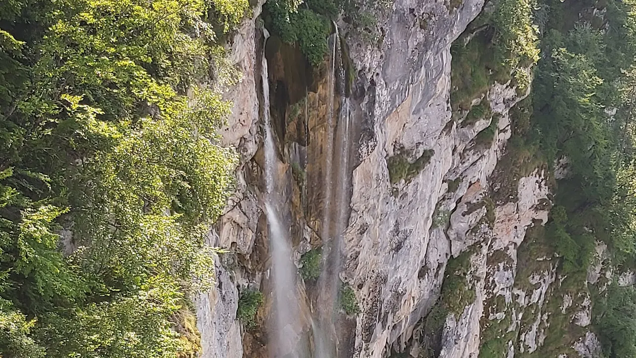
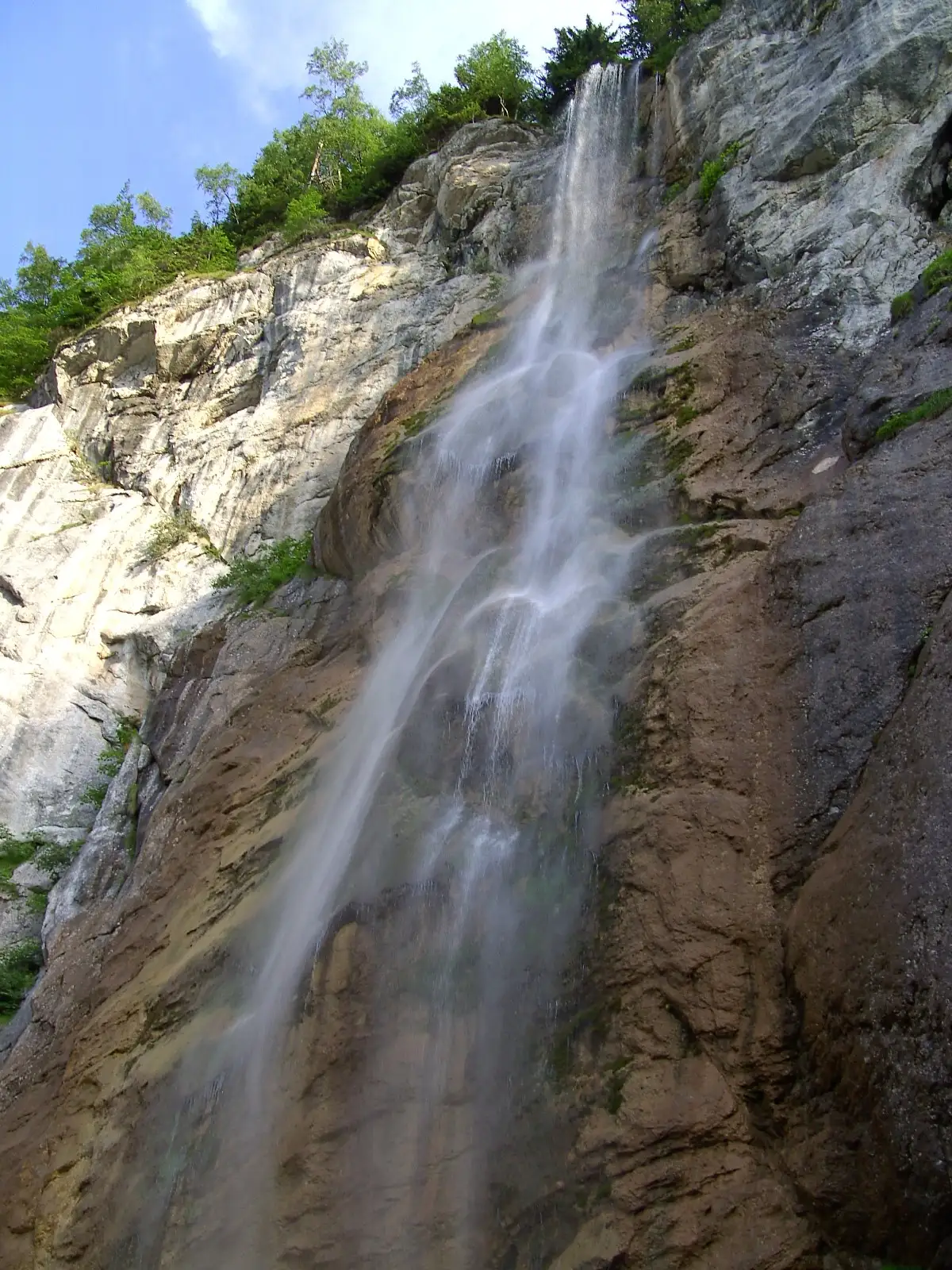
Skakavac is a 98-metre waterfall in the forest above Sarajevo - about 12 km northeast of the old town - and it’s the tallest single drop in Bosnia and Herzegovina by most counts. You don’t drive to the base; you walk a marked loop of about 9.2 km through spruce and beech, usually three to four hours, with a choice between a cliff-top viewpoint and a stepped path down to the foot. There’s no entry fee, no swimming hole, and no cable car - just a proper half-day hike that Sarajevans have treated as a picnic escape for decades. Don’t count on public transport - GRAS has no timetables online at the moment - and remember that August dry spells can shrink the fall to a ribbon.
The name means “grasshopper” in Bosnian, which sounds whimsical until you see the fall: a narrow column off a hard limestone lip, not the wide tufa curtains you get at Kravice or on the Una. That’s why photographers come - height and contrast - and why you shouldn’t arrive in August expecting a thundering volume. Skakavac is at its loudest after snowmelt and spring rain; in a dry late summer it can look more like a silver thread. Winter is a different spectacle entirely, when the face freezes into shapes that change week to week.
The short answer
| Detail | |
|---|---|
| Height | 98 m (322 ft) - tallest in BiH by most counts |
| Distance from Sarajevo | about 12 km to Nahorevo / trailhead area |
| Main loop | about 9.2 km, about 4 h, about 900 m up and down |
| Difficulty | Easy to moderate forest walking; steep, wet steps at the base |
| Cost | Free |
| Swim? | No |
| Best months | April-June for flow; winter for ice; avoid expecting volume in late August |
| Access | Car, taxi, or city minibus to Nahorevo, then on foot past the turnpike |
Figures follow the marked Via Dinarica loop description as of August 2026 - always pack a downloaded map, because phone signal dies in the trees.
What you’re walking to
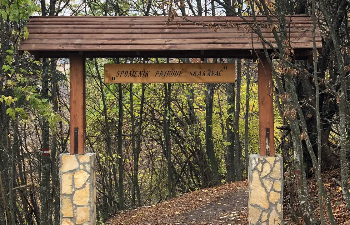
The fall sits in the Skakavac nature monument, a protected patch of just over 14 km² on the slopes of Sarajevo’s Ozren, declared by the Sarajevo Canton in 2002 (the area has been treated as a reserve since the 1950s). The stream of the same name drops off a vertical limestone face under the peak of Bukovik (about 1,532 m), and runs on into Perak Creek. The forest around it is mixed spruce-fir and beech-fir, with a handful of endemic plants that explain the protection status - you’re not in alpine bare rock here, you’re in deep shade most of the way.
What Skakavac is not: a second Perućica Skakavac. Bosnia has another waterfall with the same name deep inside Sutjeska National Park in the southeast - about 75 metres, visible only from a distant platform in the primeval forest. Same word, opposite end of the country. If your hotel concierge says “Skakavac,” they mean this one above Sarajevo; if a ranger mentions Perućica, that’s the other trip entirely. The comparison table in our roundup of the best waterfalls in Bosnia keeps the two straight.
The hike: upper view, lower view, loop back
Most people follow the classic Nahorevo loop described on the Via Dinarica portal: roughly 9.2 km, 902 m of ascent and the same down, highest point 1,218 m, lowest about 970 m, clocked by other walkers at just under four hours plus picnic time. It’s classified as an easy forest walk, which is fair - there’s no scrambling - but “easy” still means 900 metres of cumulative climbing spread through a humid wood. If you’re coming from sea level and spent yesterday in Baščaršija cafés, you’ll feel it.
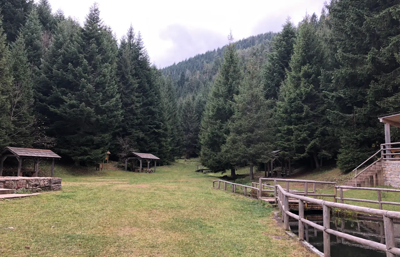
The road in splits early. Take the upper branch first: a shaded track wide enough for a single car, with a drinking fountain and benches after the first few hundred metres, then a turnpike where private vehicles stop. Past that gate you’re inside the monument; placards name local flora and fauna along the way. A destroyed wartime chalet sits above the stream - a reminder that this picnic ground was front-line country in the 1990s - and a wooden sign points left to the promontory where you first see the full 98-metre drop.
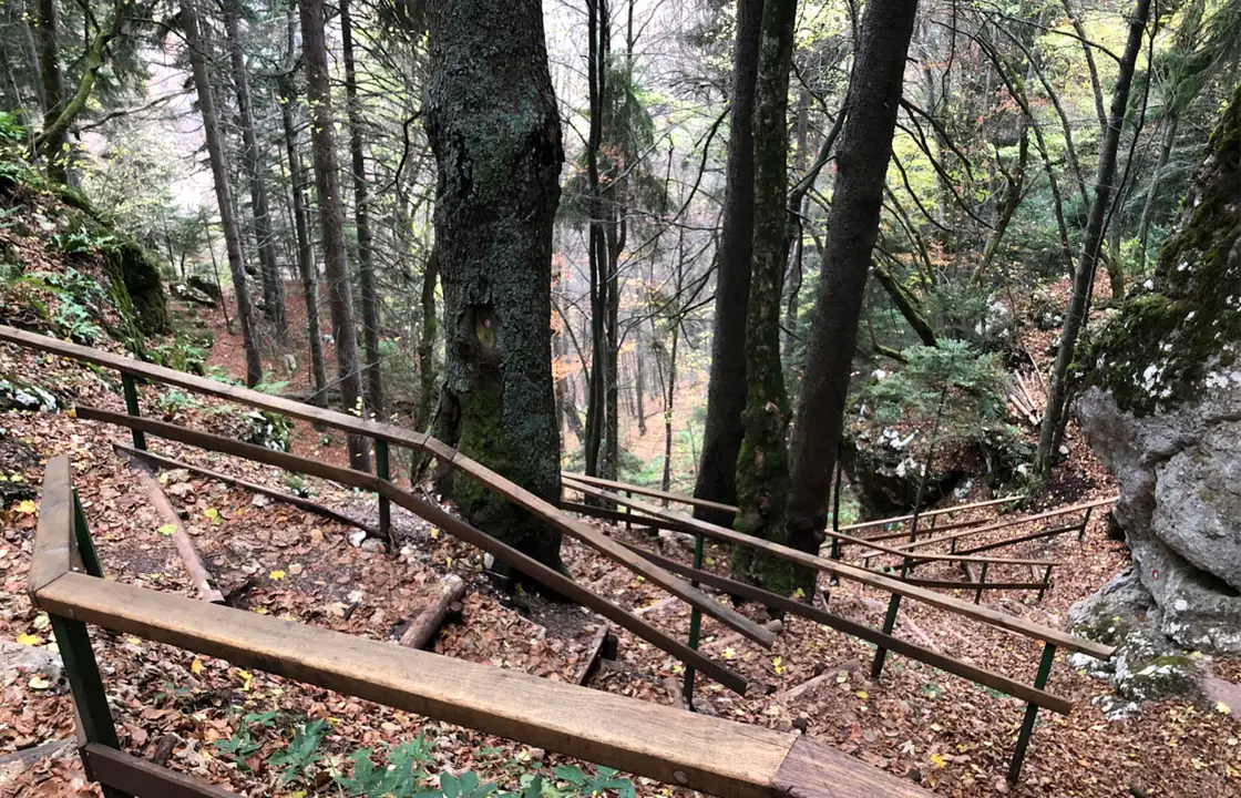
From the promontory a maintained path with railing descends to the base. The rocks stay wet year-round; tread carefully even when the railing is dry. The lower road through the forest is the gentler return leg - a proper dirt trail wide enough for two abreast, with improvised wooden bridges over seasonal stream beds that only run after rain. You don’t have to retrace every metre; the marked loop brings you back towards the trailhead without repeating the steepest descent.
Mountain bikers use the same network, which matters on summer Sundays when you’ll share the upper road with tyres as well as boots. Start early and you’ll have the promontory briefly to yourself; arrive at noon on a hot day and you’re in a Sarajevo-family traffic jam with grill smoke somewhere in the trees.
Getting to Nahorevo and the trailhead
With a car, leave central Sarajevo through Koševo and Pionirska dolina, drive through Nahorevo, and keep climbing until you reach the Skakavac nature preserve sign. The final stretch is macadam and partly asphalted; ordinary hire cars manage it slowly. There’s no big car park - parking at the barrier is limited, so you pull off where you can and walk from there. Don’t block the turnpike; rangers and locals will move you.
Without a car, the practical pattern is a city minibus or taxi to Nahorevo. A kombi minibus serves Nahorevo, but GRAS’s bus and minibus schedule pages both read “u izradi” - under construction - so you won’t find the times online. Ask at your accommodation, or budget for a taxi. A taxi from the centre to the trailhead area is the fallback most visitors use; agree a return time or phone signal to call back, because Nahorevo isn’t awash with idle cabs on weekdays.
You can also walk from Sarajevo through Nahorevo and into the preserve - a long urban-to-forest day - but almost nobody on a short city break does it; the car or taxi leg exists for a reason. For how Skakavac fits among other escapes from the capital - Mostar, Jajce, the Olympic ridges - see day trips from Sarajevo; this hike is the local nature option on that list, not a replacement for Herzegovina.
When the waterfall earns the climb
April through June is the honest peak: snowmelt and spring storms keep the lip busy, the forest is green, and the mud on the lower path is manageable if you’ve got tread on your shoes. July and August are fine for the walk but punishing for the photograph - heat, haze, and a fall that may barely register in your phone frame after a dry spell. September can be the sweet spot if an early rain revives the stream. Winter is underrated: the column freezes in layers, the promontory feels alpine, and the trail under the face can ice over - the Via Dinarica safety note warns to tread carefully on those steps when they’re frozen.
There’s no ticket window turning you away in the off-season; the constraint is daylight and whether you trust your footing. Weekends from spring to autumn bring picnic groups from the city; weekdays are quieter and better for photography.
Landmines, gear, and the habits that matter
This trail belongs to a short list of mountain walks near Sarajevo where the Via Dinarica safety sheet explicitly states no landmine risk on the marked route - unlike the open-country rules that govern much of hiking in Bosnia, where staying on signed paths is non-negotiable everywhere else. That doesn’t mean wandering off into the scrub “because it’s close to town.” Stick to the marked loop; the wartime chalet ruins are not an invitation to explore off-piste.
Pack water (a litre per person is a minimum in summer), layers - the promontory runs noticeably cooler than Baščaršija - and grip on your shoes for the base. Trekking poles help on the descent. There’s no shop at the fall; Nahorevo may have a café, but don’t count on it before 10:00. Toilets are sporadic. Mobile coverage fades once you’re past the turnpike.
Dogs are common on local walks; leave them leashed near the cliff steps. Bears sign the deeper forest occasionally - paw-print photos on local trail blogs aren’t marketing fiction - which is another reason not to camp wild here.
Who should go, and who should skip
| You… | Verdict |
|---|---|
| Have a free half-day in Sarajevo and want forest without driving to Sutjeska | Go - this is the default nature hike |
| Need a swim after sightseeing | Skip - head south to Kravice instead |
| Can’t walk 9 km with hills | Skip or hire a local guide for a shortened out-and-back to the promontory only |
| Want Bosnia’s tallest fall and don’t mind a thin stream | Go in spring |
| Only have winter city time and no crampons | Skip the base steps; the promontory alone may be enough if the path is icy |
Skakavac won’t give you the pool-and-beer afternoon that Kravice sells, and it won’t give you the town-centre surprise of Pliva at Jajce. What it gives you is proximity: a genuine 98-metre fall above a capital city, on a loop you can still finish in time for dinner in Baščaršija. Start early, check the bus home while you’ve got signal, and treat the flow charts on tourism sites as optimism until you see the cliff with your own eyes.
Photos
On the map
The map loads on click - to keep the page lightweight.
The map didn’t load. Check your connection and refresh the page.
Admission and opening hours
- Admission price
- Free - no gate or ticket on the trail as of August 2026. Carry cash in convertible marks (KM) if you stop for coffee in Nahorevo; cards are not guaranteed.
- Opening hours
- Open access at any hour. Daylight hours are sensible: the forest road is unlit and the rocks at the base stay slippery after rain.
Not a swimming spot. Flow is modest even at its best; late-summer dry spells can reduce the fall to a ribbon. Public transport is unreliable here and GRAS publishes no timetables online - plan a car or a taxi.
Details checked: August 26, 2026
Distance ≈12 km · about 30 min by car to Nahorevo, then 3-4 h on foot for the main loop
- Sarajevo ≈12 km · about 30 min by car to Nahorevo, then 3-4 h on foot for the main loop Drive via Koševo and Pionirska dolina towards Nahorevo, then continue to the nature-preserve sign. Without a car, a kombi minibus or taxi to Nahorevo is the usual start; no timetable is published online.
Read also

What to see · 15 min read
Via Dinarica Bosnia: Huts, Stages & Logistics
Verified · September 12, 2026Plan the Via Dinarica White Trail in Bosnia: 12 stages, 334 km, hut booking, trailheads, closures and three workable section packages.

What to see · 10 min read
Jablanica: Neretva Bridge & Roast Lamb Stop
Verified · September 4, 2026Jablanica on the Sarajevo-Mostar road: Battle for the Wounded museum (5 KM), the 1943 bridge, roast lamb lunch. Hours, parking, how long to stop.

What to see · 8 min read
Prokoško Lake: Shepherd Huts High Above Fojnica
Verified · September 3, 2026Prokoško on Vranica at 1,636 m: katuni, gate prices for foreigners, no swimming, and the 2026 asphalt climb from Fojnica.

What to see · 11 min read
Franz Ferdinand's Sarajevo: Latin Bridge & 1914 Site
Verified · August 29, 2026The Latin Bridge corner in Sarajevo where Franz Ferdinand was shot in 1914: what happened, the Museum of Sarajevo 1878-1918 inside, hours and tickets.