Sutjeska National Park & Maglić
Sutjeska, Bosnia's oldest national park: climbing Maglić, the Perućica primeval forest, the Tjentište war memorial and Trnovačko lake, tips and season.
Sutjeska is Bosnia and Herzegovina’s oldest and wildest national park, and its greatest hits are heavyweight: Maglić, the highest mountain in the country at over 2,386 metres; Perućica, one of the last two primeval forests left in Europe; and the vast, strange Tjentište war memorial to a 1943 battle. Established in 1962 and spread across roughly 170 km² near Foča on the Montenegrin border, this is where you come for serious mountains and genuine wilderness rather than day-trip sightseeing. This guide covers the peak, the forest, the memorial and the practical realities of getting to a park this remote.
What Sutjeska is, and where
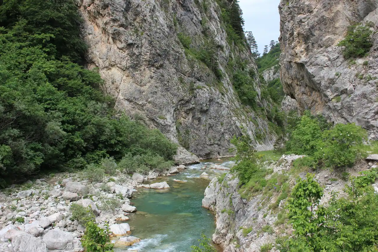
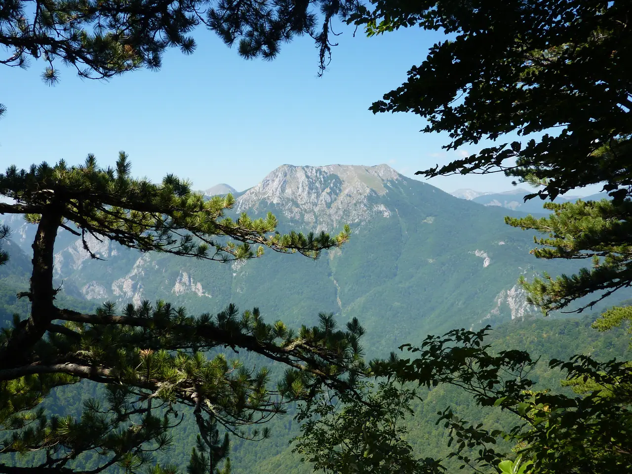
The park sits in the far southeast of the country, in Republika Srpska, hard against the border with Montenegro and reached through the town of Foča. Its spine is the Sutjeska river, which has cut a canyon over a thousand metres deep through the middle of the park; the main road threads that valley, and almost everything else climbs away from it into mountains on either side. To the west rises the rounded massif of Zelengora, dotted with glacial lakes; to the east, the sheer wall of Maglić.
This is not a place you pass through on the way to somewhere else. It is a destination in its own right, a couple of hours off the classic Sarajevo-Mostar circuit, and it rewards people who like their nature raw: bears and wolves still live here, the forest in Perućica has never been logged, and the trails are for walkers rather than strollers. If your idea of Bosnia is the Old Bridge and a coffee, this is the opposite pole of the same country.
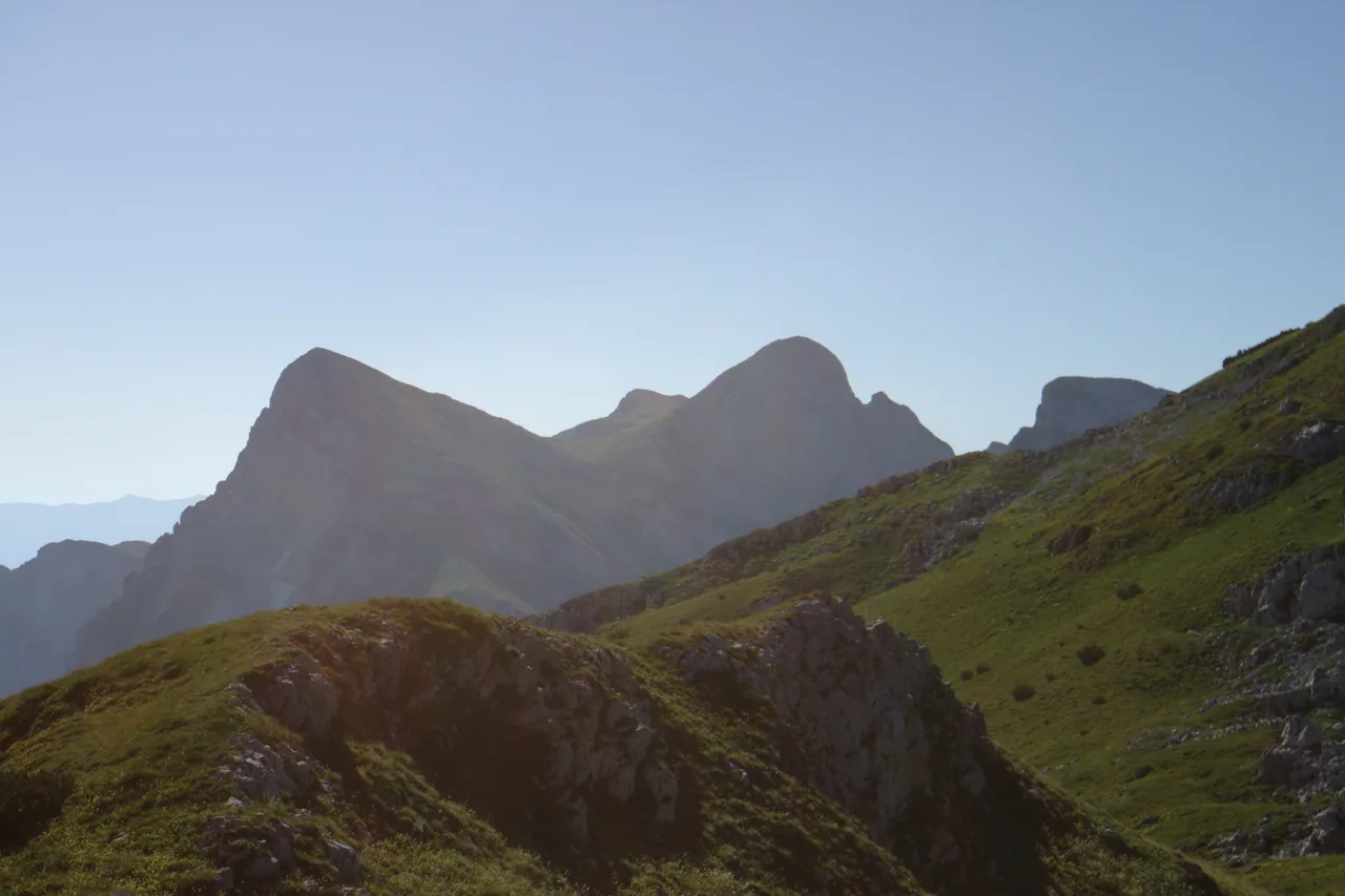
Climbing Maglić, Bosnia’s highest peak
Maglić (over 2,386 m) is the reason a lot of hikers make the trip, and it is a proper mountain, not a marked stroll to a summit cross. The peak straddles the border with Montenegro, and the usual approach starts high, from the Prijevor saddle, which you reach by a rough mountain track above the valley (a sturdy or high-clearance car helps, and some drive up the day before and camp).
From Prijevor the climb to the top is a steep, exposed scramble with sections of chain and cable near the summit, and loose rock throughout. In clear weather the reward is enormous: the whole tangle of the Dinaric Alps below you, Montenegro’s Durmitor across the way, and Trnovačko lake glinting far beneath. But this is high, serious terrain: weather turns fast, cloud can swallow the ridge in minutes (Maglić means “the foggy one”), and snow clings to the upper slopes into early summer. Go with good boots, real layers and a check of the forecast, and if you are not a confident scrambler, this is a peak to attempt with a guide. It is also worth checking that your travel insurance for Bosnia actually covers a mountain like this, as some policies class serious hiking as an adventure activity that needs an add-on.
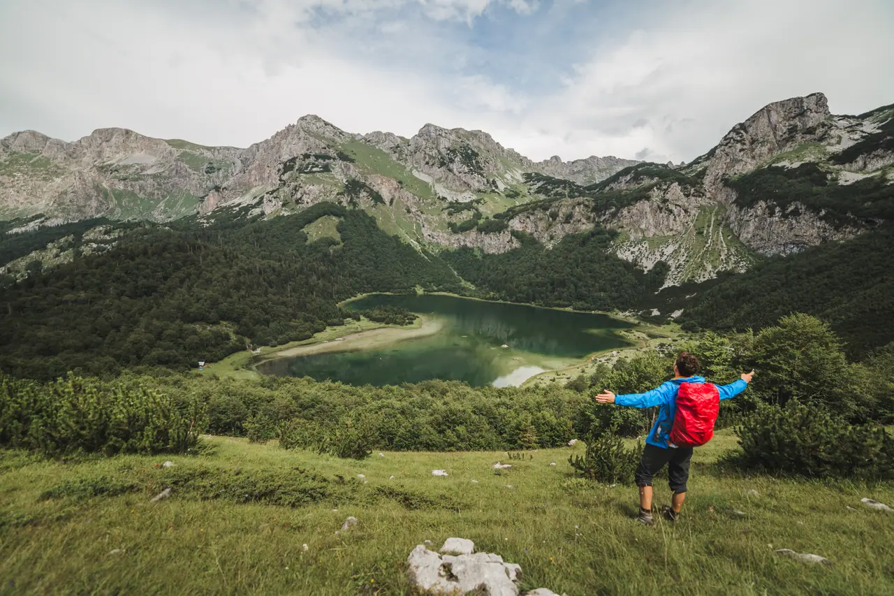
Trnovačko lake: the famous view (which is in Montenegro)
The heart-shaped Trnovačko lake below Maglić is the image that sells Sutjeska, and it is worth clearing up a common muddle: the lake itself lies just over the border in Montenegro, a short walk beyond the park boundary, sitting at about 1,500 metres. You reach it on foot from Prijevor, the same saddle used for Maglić, on a much gentler walk than the summit climb - which makes it the pick for anyone who wants the alpine scenery without the scramble. It is one of the loveliest spots in the whole massif, Bosnian or not.
Perućica: one of Europe’s last primeval forests
If Maglić is the muscle, Perućica is the soul of the park. It is a strict nature reserve protecting roughly 1,400 hectares of forest that has never been cut - one of only two primeval (old-growth) forests left in Europe, with beech and fir up to around 300 years old, fallen giants left to rot where they land, and a tangle of life you simply do not see in a managed wood. Deep inside it, the Skakavac waterfall drops some 75 metres through the trees.
There is one condition, and it is a good one: because it is a strict reserve, you cannot wander into Perućica freely - access is with a park guide, arranged at the visitor centre, both to protect the forest and because it is genuinely wild ground. Most visitors take in the reserve from the Vidikovac viewpoint on its edge, which looks out over the sea of ancient canopy to the Skakavac falls across the valley - a stop you can do without a full guided trek. If you want to walk in among the old trees, arrange the guided visit ahead, and treat the fee and rules as part of what keeps the place intact.
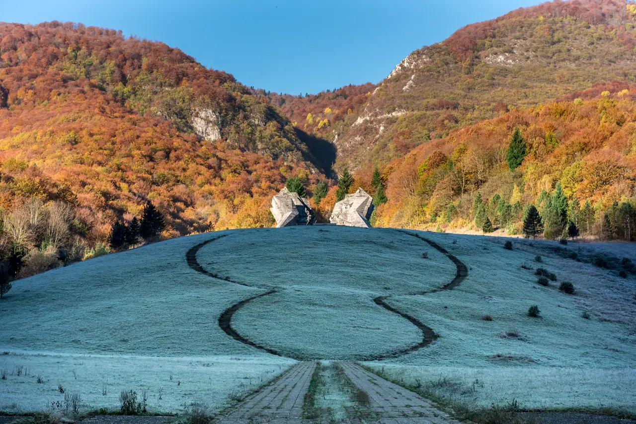
The Tjentište memorial and the Battle of the Sutjeska
At the northern end of the park, in the valley at Tjentište, two enormous concrete wings rear out of a hillside - the Sutjeska war memorial, and one of the most striking pieces of monumental sculpture anywhere in the former Yugoslavia. It marks the Battle of the Sutjeska, fought here over several brutal weeks in May and June 1943, when Yugoslav Partisans were encircled by a far larger Axis force and broke out across these mountains at enormous cost. The two split, angular forms - designed by the sculptor Miodrag Živković and unveiled in 1971 - are meant to evoke the breakthrough, a wound opening to let the fighters through.
Whatever you make of the politics, it is an arresting thing to stand beneath, and it comes with a small memorial house and frescoed hall nearby. For many travellers the monument is the easiest single reason to stop at Sutjeska - it sits right by the main road and the visitor centre, so you can take it in even if you never lace up for the mountains.
Gentler walks: the Zelengora lakes
Not everyone wants to scramble up Maglić, and Sutjeska has a softer side on Zelengora, the broad grassy massif on the western side of the park. Its high meadows hold a scatter of glacial lakes the locals call the “Gorske oči” - the “eyes of the mountain” - among them Crno, Bijelo and Orlovačko. The walking here is more rolling than vertical: long days across open ridges and beside quiet tarns, with none of Maglić’s exposure. It is the part of the park for anyone who wants big-mountain scenery and a full day out without a head for heights.
When to go, and getting there
The honest window for Sutjeska is June to September. Outside it, the high trails are snowbound or dangerous, the Prijevor track can be impassable, and the whole park shrinks to the valley and the monument. Midsummer gives you the most reliable weather for Maglić and the lakes; our guide to the best time to visit Bosnia sets out the seasons across the country if you are timing a wider trip.
Getting here takes commitment. Sutjeska is roughly 130 km and three to three and a half hours from Sarajevo, out past Foča with no useful public transport to the trailheads - so you need your own car or an organised trip. Foča is also the Bosnian launch point for rafting the Tara, the deepest canyon in Europe, so many visitors pair the two; our guide to rafting in Bosnia has the detail. Bring cash in convertible marks for the park fee and anything in the villages, fill the tank before you go, and do not count on mobile signal in the valleys. The nearest beds are simple guesthouses and campsites around Tjentište and Foča; most hikers overnight there to get an early start on the mountain.
Is it worth the trip?
For a first, short visit to Bosnia built around Sarajevo and Mostar, Sutjeska is probably a detour too far - it needs a full day or two and a car, and the payoff is wilderness rather than sightseeing. But if you hike, if you want the country’s highest peak and a forest older than any nation that has ruled it, or if you are drawn to that extraordinary monument, it is one of the most rewarding corners of the whole region. It pairs naturally with the wild northwest - our guide to Una National Park and Bihać covers Bosnia’s other great river-and-forest park - and if you would rather see how the wilder sights slot around the classic highlights, our 7-day Bosnia itinerary maps out the country at a manageable pace.
Photos
On the map
The map loads on click - to keep the page lightweight.
The map didn’t load. Check your connection and refresh the page.
Admission and opening hours
- Admission price
- A park entry / conservation fee applies at the visitor centre in Tjentište; guided visits into the Perućica strict reserve are arranged there and priced separately. Fees change year to year - confirm the current rate and what a Perućica guide costs when you arrive.
- Opening hours
- The park is open year-round, but the high trails (Maglić, the Zelengora lakes, the Perućica viewpoint) are a summer proposition - roughly June to September for stable weather and snow-free ground. Snow lingers near the top of Maglić into early summer.
Fees are in convertible marks (KM / BAM); carry cash, as this is a remote corner with patchy card acceptance. Perućica is a strict reserve entered only with a park guide, not freely - arrange it at the visitor centre.
Details checked: July 3, 2026
Distance≈130 km · ~3 to 3.5 h by car
- Sarajevo≈130 km · ~3 to 3.5 h by carDeep in the southeast near Foča, on the Montenegro border. There is no practical public transport to the trailheads - you want your own car or a tour.
Read also
The Siege of Sarajevo: History & Sites Today
Verified · July 4, 2026The siege of Sarajevo, 1992-1996: what happened, the death toll, and the places today - Sniper Alley, Markale, the Sarajevo Roses - to understand it.
Baščaršija: Sarajevo's Old Bazaar
Verified · July 3, 2026Baščaršija, Sarajevo's Ottoman old bazaar: the Sebilj, coppersmith street, Gazi Husrev-beg mosque, where East meets West, and the best ćevapi and coffee.
Blagaj Tekke: Visiting the Dervish House on the Buna
Verified · July 3, 2026Blagaj Tekke, the cliffside dervish house where the Buna springs from a cave 12 km from Mostar: entry, dress code, the boat, the fortress, best time.
Kravice Waterfalls: Complete Visiting Guide (2026)
Verified · July 3, 2026Kravice Waterfalls, Herzegovina: entry fee, swimming season and water temperature, how to get there from Mostar, the boat, and when to beat the crowds.