Olympic Mountains Day Loop from Sarajevo
A one-day self-drive loop of Sarajevo's 1984 Olympic mountains: Trebević, Bjelašnica, Umoljani, Lukomir, Igman and the Vrelo Bosne springs.
In one long day out of Sarajevo you can drive a full circle of the mountains that hosted the 1984 Winter Olympics, and finish at the springs where the Bosna river is born. The loop links Trebević and its abandoned bobsled track, the ski summit of Bjelašnica, the shepherd villages of Umoljani and Lukomir (the highest inhabited settlement in the country), the broken Olympic ski jumps on Igman, and the cool water park of Vrelo Bosne. It runs to roughly 135 km, you need your own car, and it only works between about May and October, because the gravel road up to Lukomir is buried in snow the rest of the year.
Be honest with yourself about the day. This is a dawn-to-dusk loop, not a gentle amble, and Lukomir alone swallows three to four hours there and back. If you would rather linger than tick boxes, drop Trebević from the drive and ride the cable car up some other evening instead; the scenic heart of the trip is the Bjelašnica-Umoljani-Lukomir stretch, and that is the part to protect.
Why you need a car, and why May to October
There’s no bus that chains these places together, and there never will be; the villages see a handful of vehicles a day and the ski roads empty out completely in summer. A hire car is essential, and treat it as a real mountain drive rather than a motorway hop. Pick the car up in Sarajevo and read our driving in Bosnia notes first; our car rental in Bosnia guide covers deposits and the paperwork.
The season is the hard limit. Lukomir’s road is impassable under deep snow from roughly November into April, and the village itself empties for winter, so the loop as a whole is a late-spring-to-autumn trip. That’s the opposite of when these mountains earn their keep as ski resorts; for the winter side of Bjelašnica and Igman, see our Bosnia in winter guide. Carry cash in convertible marks: the cable car, the Vrelo Bosne gate and the village konobas all want KM, and cards are hit and miss once you leave the city.
Trebević: the Olympic ghost above the city
Start where the Olympics still haunt the concrete. Trebević is Sarajevo’s home mountain, and just below the top cable-car station lies the 1984 bobsled and luge track, a banked concrete snake now drowned in graffiti and pocked with bullet holes from the siege, when the run was used as a firing position over the city. The cleanest way up is the cable car from Bistrik, about 30 KM (roughly €15) return, seven to nine minutes each way, with the best city view you’ll get without hiking.
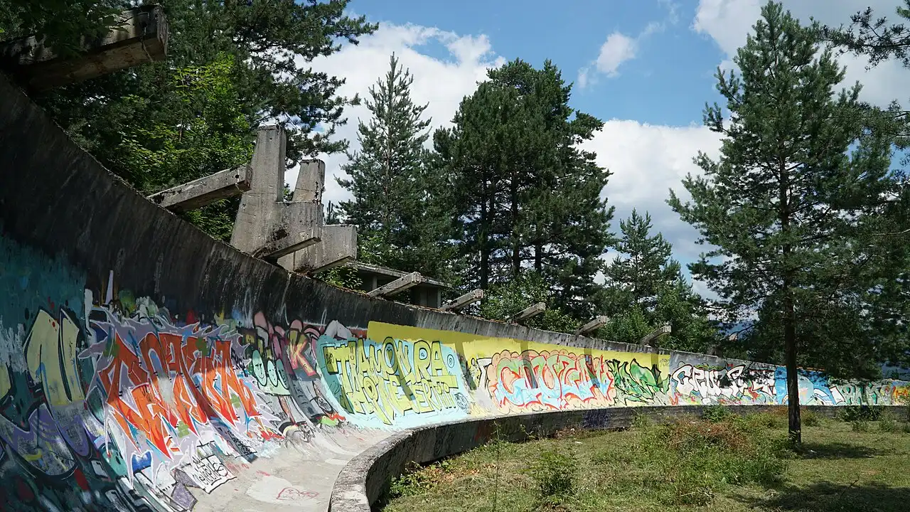
Walking the track is free, and an hour is plenty. The one caution is a real one: Trebević was among the most heavily mined slopes around Sarajevo, cleared from 2014, so stay on the concrete and the obvious trails and do not wander into the trees. Our full guide to Trebević and the bobsled track has the cable-car hours and the history in depth. From here you drop back through the city and head southwest toward the big mountains.
Bjelašnica: the Olympic mountain in summer
About 30 km out, Bjelašnica is the highest ski resort in the country and the mountain that staged the men’s alpine races in 1984. The summit reaches 2,067 m, the Babin Do base station sits at 1,267 m, and in winter this is where Sarajevo comes to ski. Arrive in July and it’s a different world: the six-seater runs for the view instead of the skiing, wildflowers on the karst, and a high, bare plateau that feels a long way from the city you can still just about see.
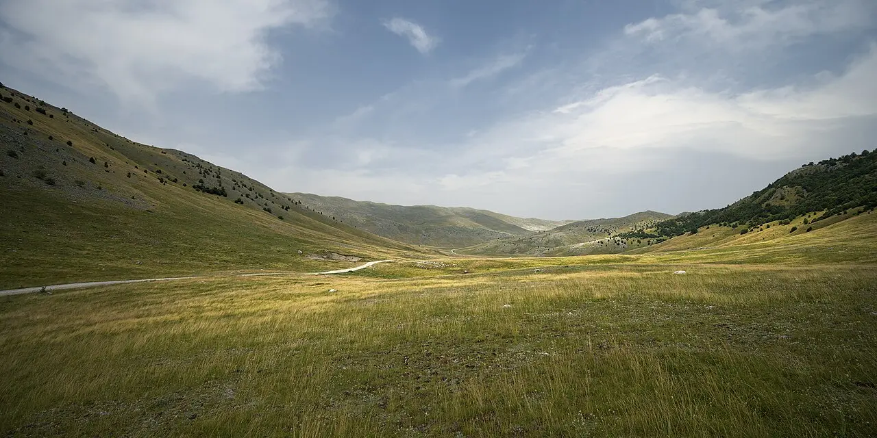
Most people stop for a coffee at the resort and press on, because the real reward is past the lifts, where the tarmac narrows and the mountain empties out. This is the point where the drive stops being a day trip and starts feeling like an expedition.
Umoljani: dragons, stone tombs and a mosque that survived
Thirteen kilometres on, Umoljani is a working shepherds’ village at around 1,300 m, and the kind of place that comes with its own mythology. The fin of folded rock on the slope above the houses is, in local legend, a dragon turned to stone as it fled the Rakitnica canyon; the stream below, the Studeni Potok, is said to be the trail it left, and it runs in a long staircase of cascades in spring and autumn.
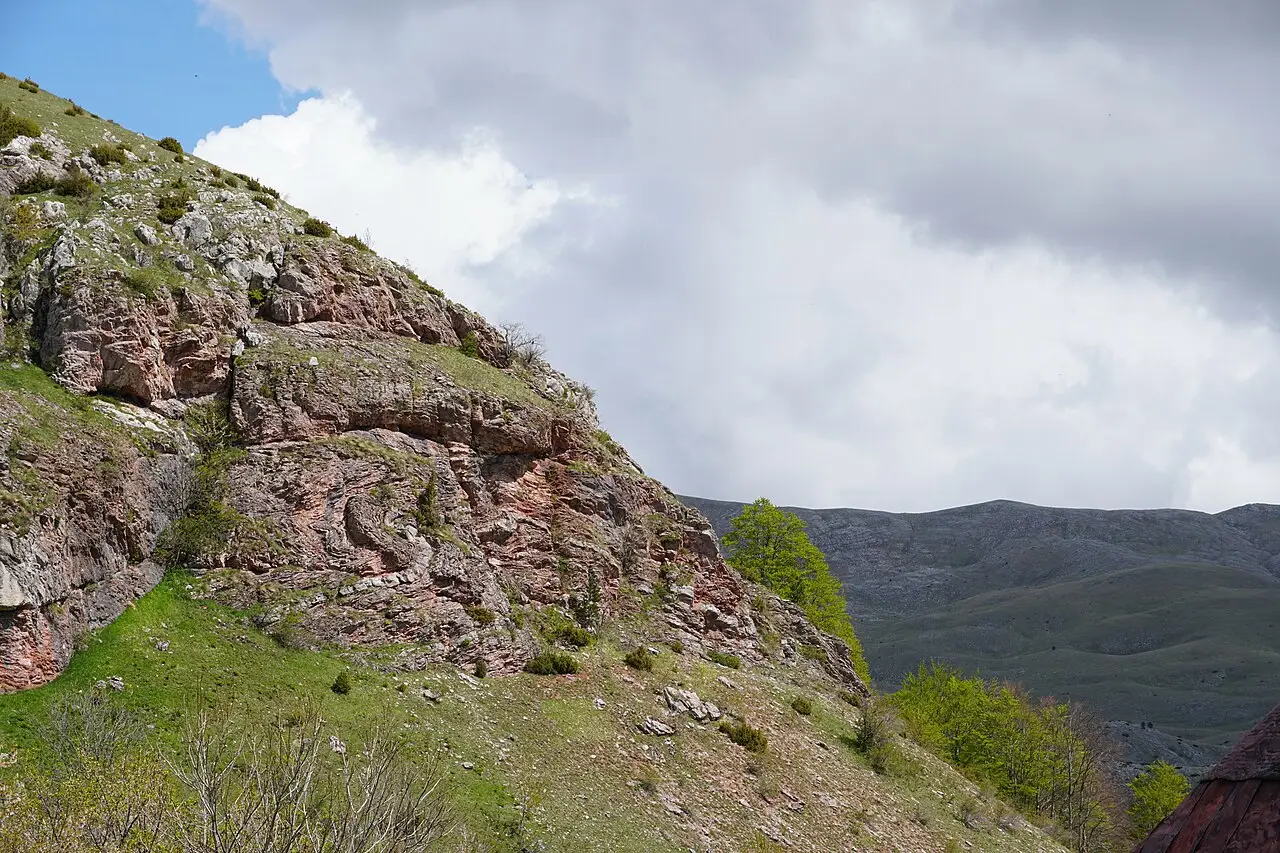
There’s real history here too. The Umoljani mosque is the only mosque in the Bjelašnica villages to survive the 1990s war, and the medieval stećci (carved Bosnian tombstones) in the Dolovi necropolis nearby belong to a group inscribed on the UNESCO World Heritage List in 2016. It’s a quick stop, twenty minutes to stretch your legs and look up at the dragon, but it sets up Lukomir well.
Lukomir: the highest village and the road that guards it
This is the one you came for. Lukomir sits at roughly 1,500 m on the shoulder of Bjelašnica, above the plunging Rakitnica canyon, and it’s the highest permanently inhabited village in Bosnia and Herzegovina. The stone houses with their shingle roofs, the loose flocks of sheep and the sheer absence of trees make it feel genuinely remote, because it is: this is a semi-nomadic place whose families come up for the warm months and leave before the snow.
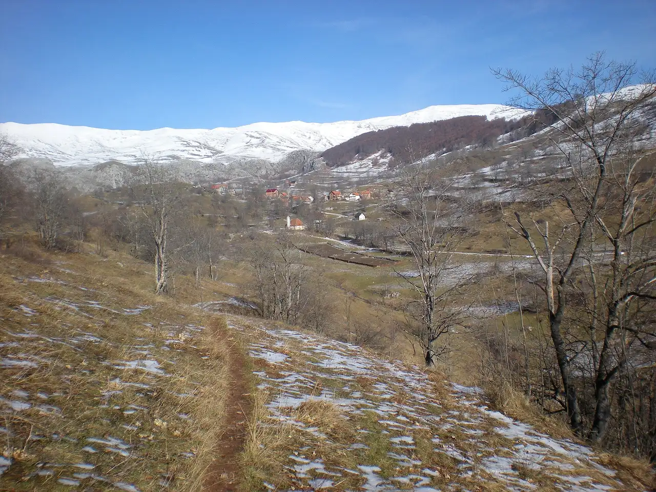
About the road, because it’s the thing people worry over. The last 11 km is gravel, twisting across bare karst, and it is the filter that keeps Lukomir quiet. In dry summer weather a normal car does it fine if you go slow and mind your ground clearance; after rain, or early and late in the season, a higher car or a 4x4 is far more comfortable and sometimes necessary. Give yourself two hours in the village: eat at one of the konobas (fresh trout, pita, sour milk), walk out to the canyon rim, and go early, because midday brings the tour vans up from the city and the peace goes with them. If you would rather hike the last stretch, the trail from Umoljani is a classic half-day, and our guide to hiking in Bosnia has it in full alongside the country’s other big massifs.
Igman: the broken ski jumps
Back down and across toward home, Igman carries the strangest Olympic relic of the lot. At Malo Polje stand the ruined ski jumps built for 1984, where Finland’s Matti Nykänen set a hill record of 116 m in front of 90,000 spectators. The wooden jumps were destroyed during the war and the concrete towers were left wrecked; today they loom out of the forest like the bones of something huge.
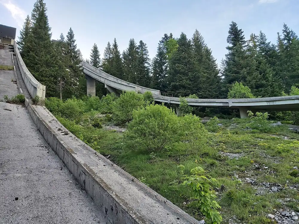
It’s a short stop, fifteen minutes to stand under the jumps and take it in, but it lands hard after a day spent among these mountains. The nearby Veliko Polje was the cross-country and biathlon venue, and its 39 km of Nordic and biathlon trails are still in use, walked and cycled in summer and skied in winter; the old Hotel Igman on the plateau housed athletes and reporters as Olympic Village B. Like Trebević, the message is the same: the same slopes that staged the games became the front line a decade later.
Vrelo Bosne: springs to finish on
End somewhere soft. Vrelo Bosne, at the foot of Igman on the edge of Ilidža, is the spring where the Bosna river wells up out of the ground, and it has been Sarajevo’s favourite green escape for generations. Entry is about 6 KM, and the 3 km Velika Aleja avenue runs in from Ilidža lined with plane trees; you can walk it, or take one of the horse-drawn carriages that have clopped up and down it for more than a century.
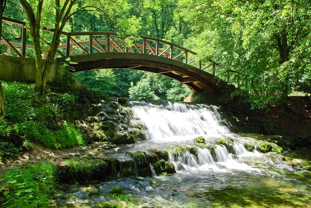
After the bare heights of Lukomir, the shade and the ducks and the cold water are exactly the right note to close on, and it’s only about 12 km back into the city from here. Sort a base for the night with our where to stay in Bosnia guide.
How to run the loop
A few things that make the day work:
- Start early, protect the middle. Aim to be on the Bjelašnica road by mid-morning. Lukomir is the time sink and the highlight, so if the day is running long, cut Igman or Trebević rather than rushing the villages.
- Check the Lukomir road, not just the calendar. May to October is the window, but after heavy rain the gravel is greasy and a low car will scrape. If in doubt, ask at the Bjelašnica resort before you commit.
- Cash in marks. The cable car, the Vrelo Bosne gate, the carriage and the village konobas are cash-first. Draw KM in Sarajevo before you leave.
- Layers and shoes. It’s several degrees cooler at 1,500 m, and the wind on the Bjelašnica plateau bites even in July. Bring a jacket and proper footwear for the canyon rim.
- Confirm prices on the day. The cable-car and Vrelo Bosne fees quoted here move with the season; treat them as a guide and check current rates on site.
Run this way, the loop packs an entire Winter Olympics, a medieval-feeling shepherd village and the source of a river into a single day within sight of Sarajevo. If you would rather slow down and treat just the two Olympic mountains as a destination in their own right, across both seasons, our Bjelašnica & Igman guide goes deeper on the ski numbers, the derelict jumps and the mountains’ wartime history. For a completely different slice of the country by car, our northeast Bosnia loop heads up the Bosna valley to Vranduk and the Tuzla salt lakes, and the day trips from Sarajevo guide lays out the shorter options if a full loop is more than you want.
Route day by day
- Days on the road
- 1
- Distance
- ≈135 km
- Budget from
- 60 EUR
- Best season
- May, June, July, August, September, October
The route at a glance
-
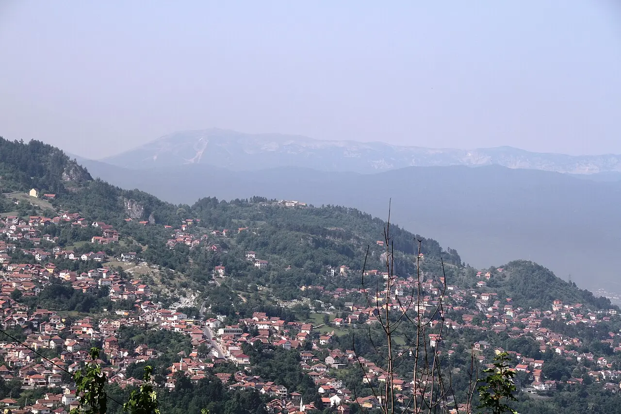
Sarajevo
Route startstop ≈0 min
Start point. Pick up a hire car, draw cash in convertible marks (BAM / KM, about 1.96 to the euro), and get moving early. The mountain villages and the Vrelo Bosne gate are cash-heavy, and Lukomir alone eats a good half of the day.
Photo: Bjoertvedt / Wikimedia Commons, CC BY-SA 3.0 ( source) -
Trebević bobsled track
6 km from the startstop ≈90 min
Sarajevo's home mountain and the fastest hit of Olympic history. Ride the cable car from Bistrik (about 30 KM / €15 return) and walk the abandoned 1984 bobsled run, now a graffiti tunnel scarred with siege bullet holes. The area was demined from 2014, so stay on the concrete and marked paths.
Photo: Adam Harangozó / Wikimedia Commons, CC BY-SA 4.0 ( source) -
Bjelašnica (Babin Do)
48 km from the startstop ≈60 min
The Olympic alpine mountain, about 30 km southwest of the city. The summit tops out at 2,067 m; the Babin Do base sits at 1,267 m and ran the men's downhill in 1984. In summer the lifts are quiet and the high plateau opens up for walking; this is also the gateway to the villages beyond.
Photo: Miha Peče / Wikimedia Commons, CC BY-SA 4.0 ( source) -
Umoljani
61 km from the startstop ≈60 min
A shepherds' village around 1,300 m, wrapped in legend. The folded rock above the houses is said to be a dragon turned to stone as it fled the Rakitnica canyon; its trail is the Studeni Potok stream. The village mosque is the only one in the Bjelašnica villages to survive the 1990s war.
Photo: Berggarten / Wikimedia Commons, CC BY-SA 4.0 ( source) -
Lukomir
74 km from the startstop ≈120 min
Bosnia's highest permanently inhabited village, roughly 1,500 m up on the shoulder of Bjelašnica, above the Rakitnica canyon. The last 11 km is gravel; the whole road is snowed shut from about November to April, so this loop only works May to October. Stone houses, a scatter of sheep, and a couple of konobas for lunch.
Photo: Frfincon / Wikimedia Commons, CC BY-SA 3.0 ( source) -
Igman (Malo Polje)
108 km from the startstop ≈45 min
The wrecked 1984 ski jumps at Malo Polje, where Matti Nykänen flew a record 116 m in front of 90,000 people. The wooden jumps were destroyed in the war and the concrete ones stand derelict; the Veliko Polje cross-country trails nearby are back in use for walkers and skiers.
Photo: Niegodzisie / Wikimedia Commons, CC BY-SA 4.0 ( source) -
Vrelo Bosne
123 km from the startstop ≈60 min
The springs where the Bosna river surfaces at the foot of Igman, a cool green park of channels and little bridges. Entry is about 6 KM; the 3 km Velika Aleja avenue leads in from Ilidža, on foot or by the horse carriages that have run here for over a century. Then it is about 12 km back into Sarajevo.
Photo: rejflinger / Wikimedia Commons, CC BY 2.0 ( source)
Route map
The map with stops loads on click - to keep the page lightweight.
The map didn’t load. Check your connection and refresh the page.