Wild West Herzegovina Road Trip 2026: Blidinje & Livno
A 1-2 day 2026 road trip from Mostar into the mountain west: the Blidinje plateau, the Busko reservoir, and the free-roaming Livno wild horses.
Most people do Herzegovina south of Mostar, on the well-worn loop of Blagaj, Počitelj and the Kravice waterfalls. This trip goes the other way, up and west into the mountains, where the crowds thin to nothing and the scenery turns big and strange: a high karst plateau with the country’s largest mountain lake, one of Europe’s biggest man-made reservoirs, and a herd of somewhere between 700 and 1,000 wild horses running loose over the highlands above Livno. It’s a self-drive of one long day or, far better, two, covering around 290 km of slow mountain road out of Mostar and back. You need your own car, and you need cash, and in return you get the emptiest, wildest corner of Herzegovina.
Two days beats one by a wide margin here. The distances are short on paper but the roads are mountain roads, and half the point is stopping: an hour with the horses, a swim at Busko, a wander on the Blidinje plateau at the pace it deserves. Come between May and October; the plateau is snowbound and much of this shuts down in winter. For the where and when of the wider country, our best time to visit Bosnia guide breaks it down month by month.
Why this loop, and why you need a car
The south-of-Mostar circuit is beautiful and busy. This is its opposite: high, austere, karst country where you can drive for twenty minutes without meeting another car. If you’ve already done, or are planning, the Kravice and Blagaj side of Herzegovina, this is the trip that shows you the other half of the region, the mountain half, and the two barely overlap.
There’s no bus that strings these places together. The horses, Blidinje and Busko all sit off any public-transport map, on roads that see a handful of vehicles a day. That makes a hire car non-negotiable for this route, unlike the easy train-or-bus run down to Mostar. A standard car is fine for everything described below, with one honest exception noted at Livno. Pick the car up in Mostar or Sarajevo and treat this as a two-day break from the main sights. Our full car rental in Bosnia guide covers deposits, cross-border rules and what to check before you drive off.
One firm rule before you leave Mostar: top up fuel and draw cash in marks. Out here the petrol stations are sparse and card readers are unreliable. The convertible mark (BAM / KM) runs about 1.96 to the euro, and small mountain places, park kiosks and any horse guide will want cash in marks, not cards and not euros.
Diva Grabovica: the canyon gateway
Head north out of Mostar on the M-17, up the Neretva canyon toward Jablanica. About 35 km up, near Glogosnica, an easily missed road turns off west into Diva Grabovica. This is not the Blidinje plateau, though people muddle the two; it’s a separate thing, a vast glacial canyon cut into the eastern wall of the Cvrsnica massif, its floor around 700 m and its limestone sides rearing up to 1,500 m on both sides for over six kilometres.
Be clear about what you’re here for. The dead-end road up to the tiny hamlet of Grabovica is drivable and worth it for the sheer scale of the walls closing in overhead, and it makes a fine leg-stretch on the way up. But the trails from here, up to Hajducka Vrata and Plocno, are among the hardest in the Balkans, a full day of steep, exposed scrambling, not a casual walk. If you’re on the two-day version and not a hiker, give it half an hour for the views and drive on. If you came to climb Cvrsnica, this is your trailhead and you’ll want the whole day.
Back on the M-17, carry on to Jablanica, then turn up the M-17.5 (older maps and the park’s own page still say R419), which climbs hard out of the valley toward the plateau. From Jablanica it is roughly half an hour up to Blidinje.
Blidinje: the high plateau
The road tops out onto Blidinje, and the change is abrupt. The plateau has its own guide - Blidinje Nature Park covers the access roads, the weight limit on the Jablanica climb, what the lake actually is, and where the stećci stand. One minute you’re in a wooded river valley, the next you are on a bare, wind-scoured karst plateau at around 1,180 m, ringed by the Cvrsnica and Vran mountains. Cvrsnica alone carries 19 peaks over 2,000 m, topped by Plocno at 2,228 m, the highest summit in the central Dinarides. Even in July it’s jumper weather up here in the evenings, and the light does dramatic things across the grass and stone.
The heart of it’s Blidinjsko jezero, the largest mountain lake in Bosnia and Herzegovina, sitting shallow in the Dugo Polje basin. It is not a swimming lake so much as a place to walk the shore and take in the amphitheatre of peaks around it. Nearby, Risovac is the little hub of the park, a cluster of lodges and a small ski base that comes alive in winter, and Masna Luka has a mountain lodge and easy meadow walks. The park’s signature landmark is Hajducka Vrata, a natural rock gate on Cvrsnica protected since 1985 and the most popular hike up here, though reaching it’s a proper mountain day, not a stroll.
There is a local legend woven through the place: Diva Grabovceva, a 17th-century girl who, the story goes, refused a forced marriage to an Ottoman bey and paid for it, and is remembered as a symbol of steadfastness. Her memorial meadow draws a pilgrimage every year around 5 July. Entry to the park is free or a token fee if collected, and there is no parking charge, but bring what you need: shops are minimal and phone signal is patchy.
This is where the two-day version earns its keep. Stay a night on or near the plateau, at Risovac or in one of the mountain lodges, and you get Blidinje at dawn and dusk with the day-visitors gone, plus a short, unhurried run to the horses the next morning. Book ahead in summer, as beds are limited; our where to stay in Bosnia guide helps you sort a base.
The Livno wild horses
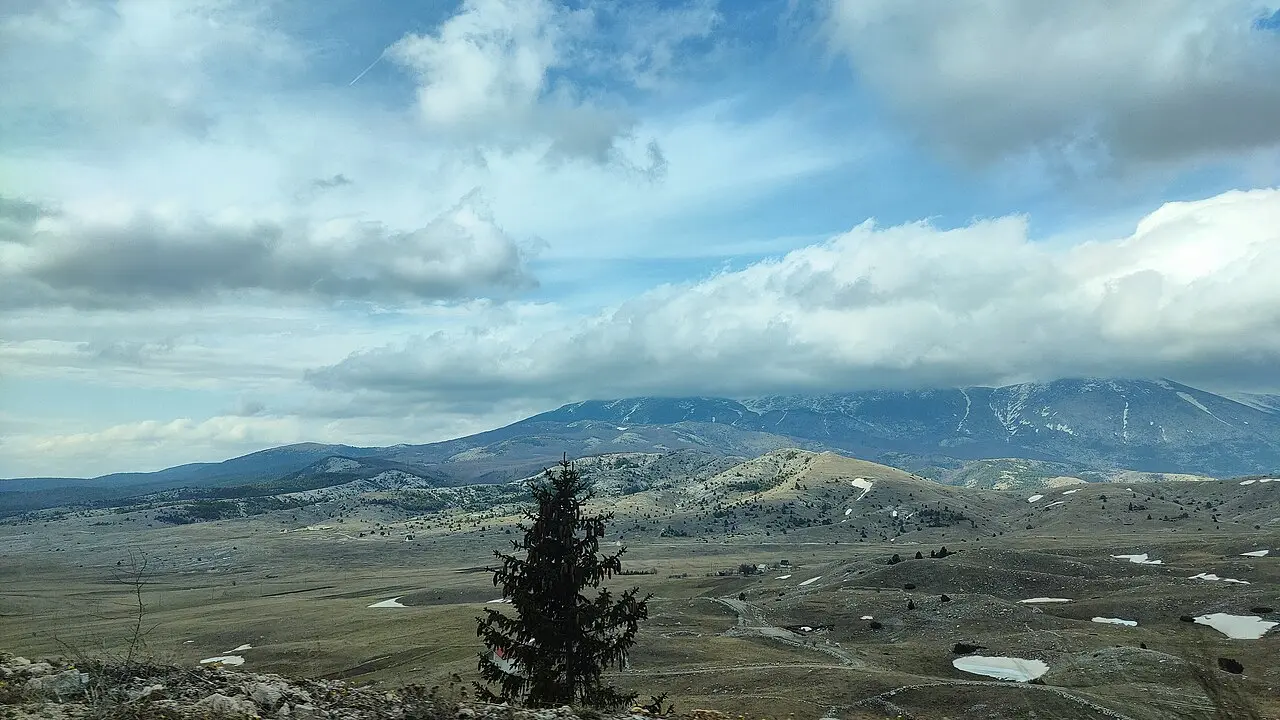
From Blidinje it is about 89 km and an hour and a half of winding road west to Livno and the main event. On the Kruzi plateau, also called Planina Krug, north of the town and under the grey bulk of Mount Cincar (2,006 m), somewhere between 700 and 1,000 wild horses (estimates vary; nobody has done a precise count since 2019) roam free across roughly 150 km² of highland grass at around 1,200 m.
They’re not native wild horses but the descendants of working farm horses turned loose in the 1970s, when tractors made them redundant; more were released during the 1990s war, when the herd dropped to around fifty before recovering to about 200 by 2010. Hunting them has been banned by municipal decree since 2013, though a proper long-term protection framework is still being worked out: Canton 10 and the University of Split only began the herd’s first scientific study, with GPS collars, in 2026. The animals up there now are genuinely wild, born and raised without handling.
Here’s the honest part on seeing them, because it decides your morning. There are two ways to do it:
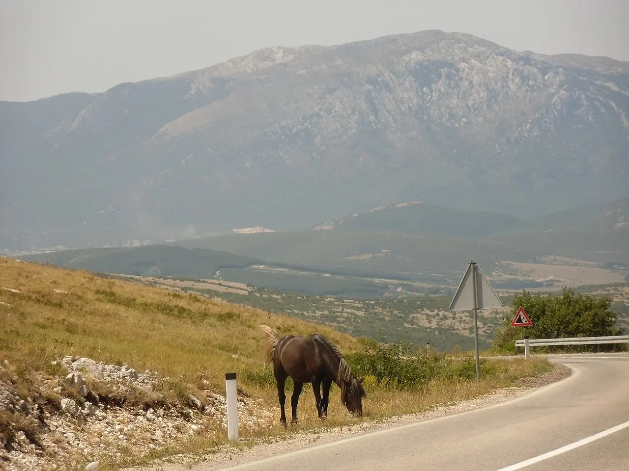
- From the road, on your own. Drive the tracks and roads around Livanjsko Polje, the huge plain below the plateau, and you have a decent chance of spotting horses grazing near the verges, especially early or late in the day. This costs nothing, works with a normal hire car, and often delivers - the photo above is exactly that. The catch: the plain is enormous and there’s no guarantee on any given day.
- Up on the plateau, with a guide. To reliably get among the herd up on Kruzi you want a local safari, because the terrain up top is rough karst full of sinkholes that a normal car should not attempt, and guides know where the horses are and are tolerated by them. Operators run 4x4 and quad trips from Livno; it costs, but it’s the sure thing.
We don’t sell those tours, and we’re not pushing one - just be clear-eyed about the trade-off. If you have a morning and want a near-certain, close encounter, take a safari. If you would rather roll the dice from the car and keep it free and flexible, work the roads around the polje with patience. Either way, June is the sweet spot, when the foals are big enough to run with the herd, and dawn or the golden hour late in the day gives the best light. They’re used to people but they are wild animals: keep your distance and don’t chase them for a photo. Our Livno wild horses guide goes deeper on this one stop alone, with current safari pricing and more on how to find the herd.
Livno itself is worth an hour if you’ve it. The Franciscan Museum and Gallery at Gorica is one of the more serious collections in the country, and the medieval Old Town fortress above the Bistrica spring makes an easy walk with a view over the plain where the horses run.
Busko jezero: the big lake and the way home
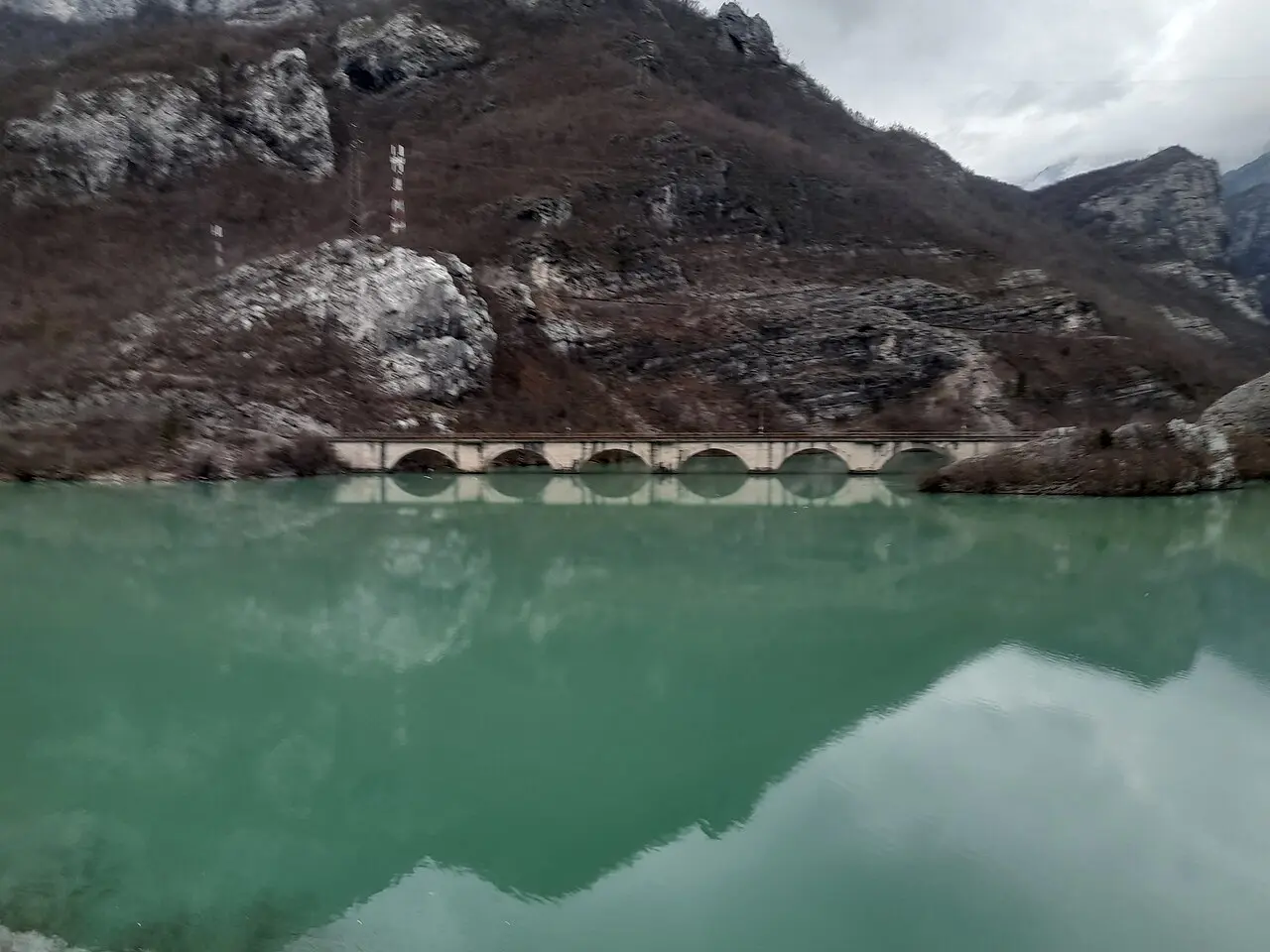
Southeast of Livno, an easy detour on the way back, is Busko jezero, and its statistics are startling: at about 56 km² it’s one of the largest man-made reservoirs in Europe, holding up to 800 million cubic metres. It was created in 1972 by flooding the Busko Blato karst basin to feed hydroelectric plants over the border on Croatia’s Cetina river, which is why the water levels rise and fall through the year.
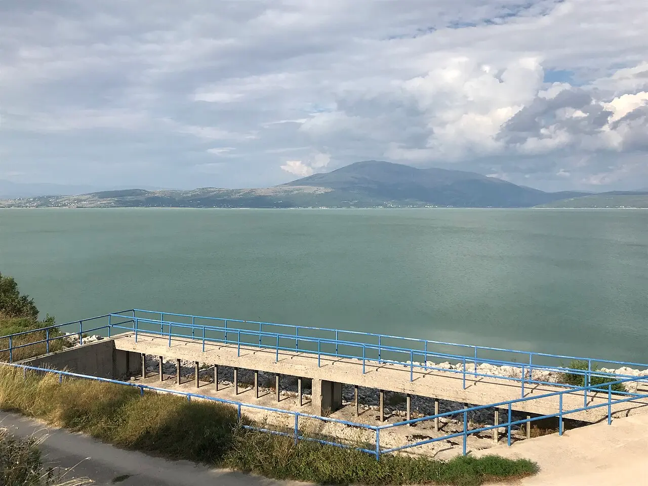
In high summer it turns into an unlikely inland beach: the shallows warm up, there are patches of fine sand, and it’s popular with fishing families from both sides of the border but rarely crowded the way the coast is. It makes a fine last stop, a swim and a coffee before the drive back. From Busko it’s roughly two to two and a half hours back to Mostar, depending on whether you retrace the plateau road or drop down and around, closing a loop of about 290 km.
Practical notes for the mountain west
A few things that keep this trip smooth:
- Fuel and cash in Mostar, always. Stations are sparse out here and card machines unreliable. Carry marks for fuel, food, park kiosks and any horse guide.
- Two days, not one. You can compress it into a very long single day, but you will spend it driving and miss the whole point, which is the stopping. A night at Blidinje or Livno transforms it.
- Layers, even in July. The plateau sits above 1,180 m and the evenings are cold. It can be 33°C in Mostar and jumper weather at Blidinje the same afternoon.
- Respect the horses and the terrain. Don’t take a normal car up onto the Kruzi plateau, and don’t chase the horses. Keep your distance and let them come to you, or don’t.
- Fill the day with a plan B. If the horses don’t show from the road and you didn’t book a safari, Blidinje and Busko still make a full, worthwhile two days on their own.
Run this way, over two unhurried days out of Mostar, the mountain west is the trip that shows you the Herzegovina almost nobody sees. If it whets your appetite for the country’s quiet corners, there’s a matching two-day loop at the other end of Bosnia: our northeast Visoko, Vranduk and Tuzla loop runs north out of Sarajevo for a fortress on a river bend and salt lakes you can swim in mid-city. And if you would rather stick to the famous south, the Mostar things-to-do guide and the Kravice waterfalls are where to start instead.
Route day by day
- Days on the road
- 2
- Distance
- ≈290 km
- Budget from
- 95 EUR
- Best season
- May, June, July, August, September, October
The route at a glance
-
Mostar
Route startstop ≈0 min
Start point. Fill the tank and draw cash in marks before you leave, because from here on the fuel stops thin out and card machines are hit and miss. Head north on the M-17 up the Neretva canyon.
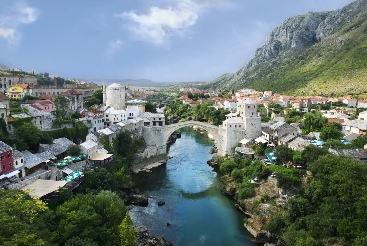
Photo: Ramirez / Wikimedia Commons, CC BY-SA 4.0 ( source) -
Diva Grabovica
35 km from the startstop ≈45 min
About 35 km north of Mostar, an unmarked turnoff west off the M-17 near Glogosnica. A dead-end road up a colossal canyon on the eastern wall of Cvrsnica. A quick leg-stretch and photo stop for most; the trailhead for serious hikers.
Photo: Argo Navis / Wikimedia Commons, CC BY-SA 4.0 ( source) -
Blidinje Nature Park
90 km from the startstop ≈180 min
Roughly 85 km from Mostar via Jablanica and the M-17.5 climb (open to vehicles up to 3.5 t). A high karst plateau at around 1,180 m holding Blidinjsko jezero, the largest mountain lake in the country, between the Cvrsnica and Vran ranges. Cool even in July. Good base for a night.
Photo: Irrmam / Wikimedia Commons, CC BY-SA 4.0 ( source) -
Livno (Kruzi plateau)
180 km from the startstop ≈240 min
The wild horses graze the Kruzi-Krug plateau north of Livno, at around 1,200 m below Mount Cincar. Estimates run from around 700 to about 1,000 - nobody has done a precise count since 2019 - but they roam free across the highland. You can often spot some from the road above Livanjsko Polje; getting up onto the plateau itself needs a 4x4.
Photo: Brian Eager / Wikimedia Commons, CC BY 2.0 ( source) -
Busko jezero
205 km from the startstop ≈90 min
A short hop southeast of Livno. One of the largest man-made reservoirs in Europe at about 56 km2, flooded in 1972 to power Croatian hydro plants. Warm and swimmable in summer, with sandy patches and quiet beaches. A good last swim before the drive back.
Photo: Petr Vilgus / Wikimedia Commons, CC BY-SA 4.0 ( source) -
Mostar (return)
290 km from the startstop ≈0 min
Loop back to Mostar, around 2 to 2.5 hours from Busko depending on the road you pick. Total for the round trip is roughly 290 km, most of it slow mountain driving rather than motorway.
Route map
The map with stops loads on click - to keep the page lightweight.
The map didn’t load. Check your connection and refresh the page.