Blidinje Nature Park: The Plateau Above Mostar
Blidinje Nature Park is a cool karst plateau about 1.5 hours from Mostar: Blidinje Lake, Dugo Polje stećci, Masna Luka pines, and why you need a car.
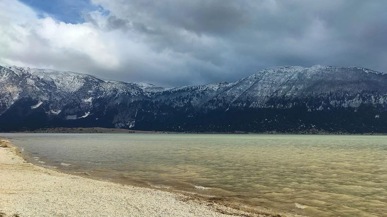
Blidinje Nature Park is a high karst plateau west of the Neretva, about an hour and a half by car from Mostar. You come for cool air at 1,150-1,300 m, for Blidinje Lake - the country’s largest mountain lake - and for a landscape that has almost nothing in common with the crowded south-of-Mostar loop of Blagaj and Kravice. The park association’s own visitor information lists no entry ticket for the landscape itself - what you pay for here are guided programmes and the ski centre. You do need your own wheels, or a driver you’ve already booked.
Most people who’ve only done Herzegovina from the Old Bridge south never realise this half exists. The altitude alone is worth the drive: leave the Old Bridge in flat July heat, climb for an hour and a half, and you’ll be reaching into the back seat for a fleece beside a shallow lake under Čvrsnica while the valley behind you stays in the low thirties.
A plateau between three mountains
The park was declared on 30 March 1995 and, by the public company’s own legislation page, covers 358 km² across three cantons. The numbers you see elsewhere sometimes drift to 364 - treat 358 as the figure the operator publishes. The massifs that wall it in are Čvrsnica (highest point Pločno, 2,228 m), Vran and Čabulja. Between them sits a long dry field - about 25 km by 5 km - that locals simply call the polje.
It looks empty until you slow down. Sheep tracks, hay barns with board roofs, wind, and a sky that feels twice as big as it does in the Neretva canyon. Park materials and the Visit Blidinje brochure put plant diversity in the region of 1,500 species, with a heavy share of endemics and relicts; you don’t need a botanist to notice that the scrub and pine here are a different country from the vineyards around Čapljina.
Blidinje Lake: big, shallow, and not a beach day
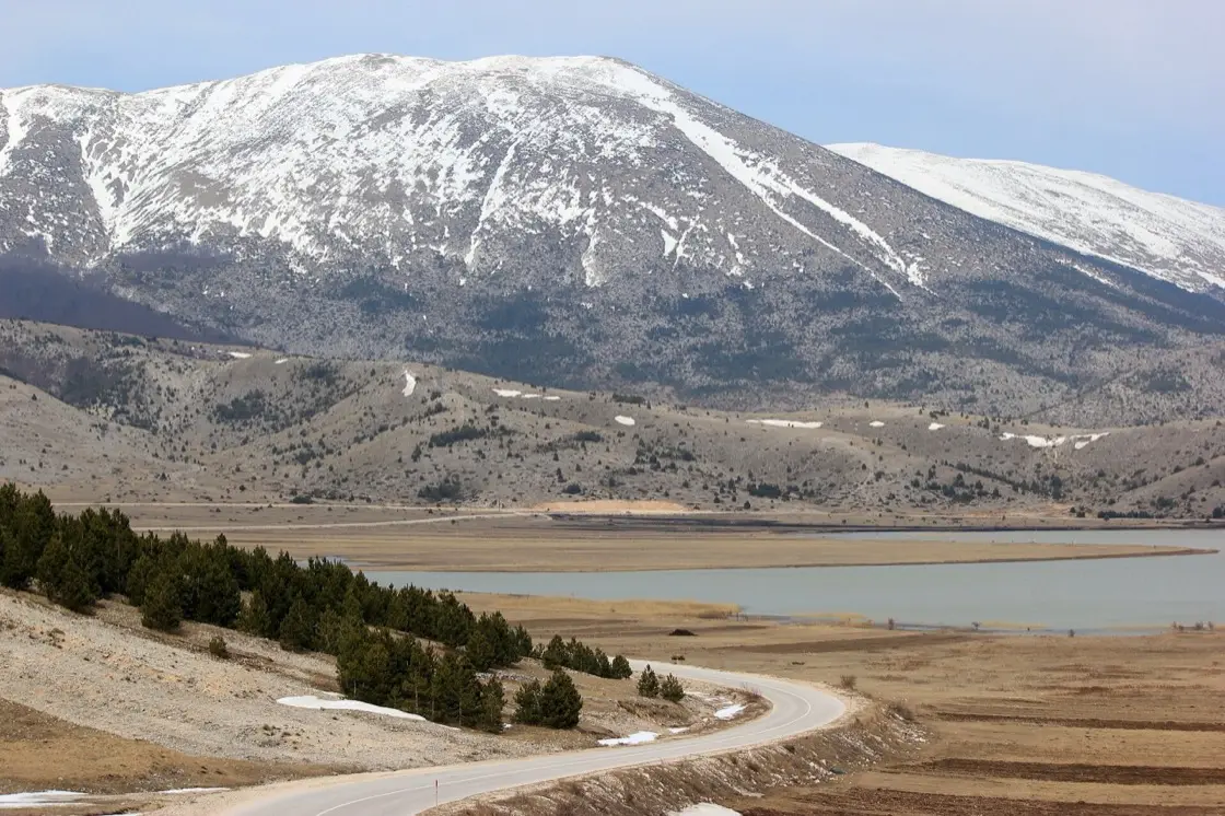
Blidinjsko jezero sits in the southeast of the park at about 1,184 m. It is the largest mountain lake in Bosnia and Herzegovina by surface, and an honest letdown if you arrived expecting Kravice-style swimming. The operator’s brochure puts the average depth at about 1.9 m and the range at half a metre to a maximum of four metres - shallow enough that this is not a swimming day. The surface itself swings hard: sources put it somewhere between roughly 2.5 and 6 km² as levels rise and fall through underground karst drains.
Here is the fact almost nobody tells you at the shore: the largest mountain lake in the country is man-made, and it is only about 140 years old. Working from parish records at Poklečani, D. Radoš showed in Geoadria (2017) that there was no lake on this polje before the end of the 19th century - meltwater flooded the field each spring and then drained away through the ponors, the karst swallow holes that riddle it. Between 1881 and 1885 local herders plugged those holes with clay and branches so the water would stay, and it has stayed since. The park operator still presents the origin as an open question; the 2017 study does not, and “glacial” looks like a label the lake inherited by habit rather than by evidence. Walk the shore, photograph the amphitheatre of peaks, don’t plan a full afternoon of laps. For how Blidinje compares with warmer Pliva and Boračko swims - and with Prokoško, where bathing is banned - see the best lakes in Bosnia guide.
Stećci on Dugo Polje
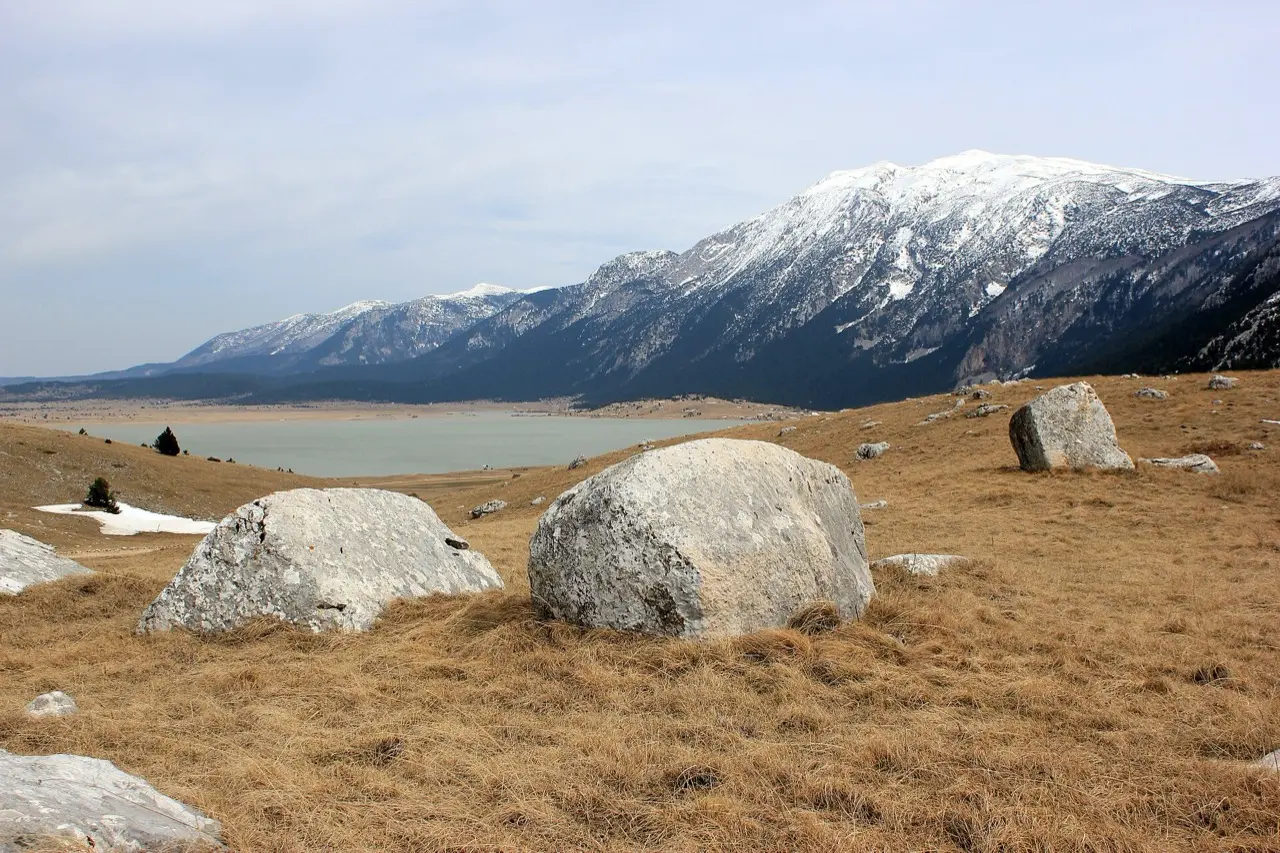
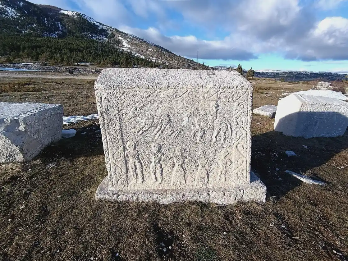
A short drive or walk from the lake brings you into Dugo Polje, where rows of medieval stećci - carved limestone tombstones - sit in the grass exactly where they were set centuries ago. This necropolis belongs to UNESCO’s serial World Heritage property Stećci Medieval Tombstone Graveyards (ref. 1504, inscribed 2016), the same transnational list that includes better-known Radimlja near Stolac.
Don’t climb on the stones or rub chalk into the carvings. They’re protected monuments, and the plateau wind already does enough damage. If you’ve only seen stećci in a roadside field with a coach bay, this setting - high, quiet, mountains on three sides - is the better memory.
Masna Luka, Bosnian pine, and where to ask for help
Masna Luka, under Čvrsnica, is the practical heart of a visit if you’re not only racing the lake and leaving. The park association and Visit Blidinje run a visitor centre here (the brochure lists sleeping space for about 35 people) with information, local products, and a base for arranging walks. Contact for bookings sits with Visit Blidinje at +387 63 428 308 / info@visit-blidinje.com (Masna Luka bb, Rakitno / Posušje).
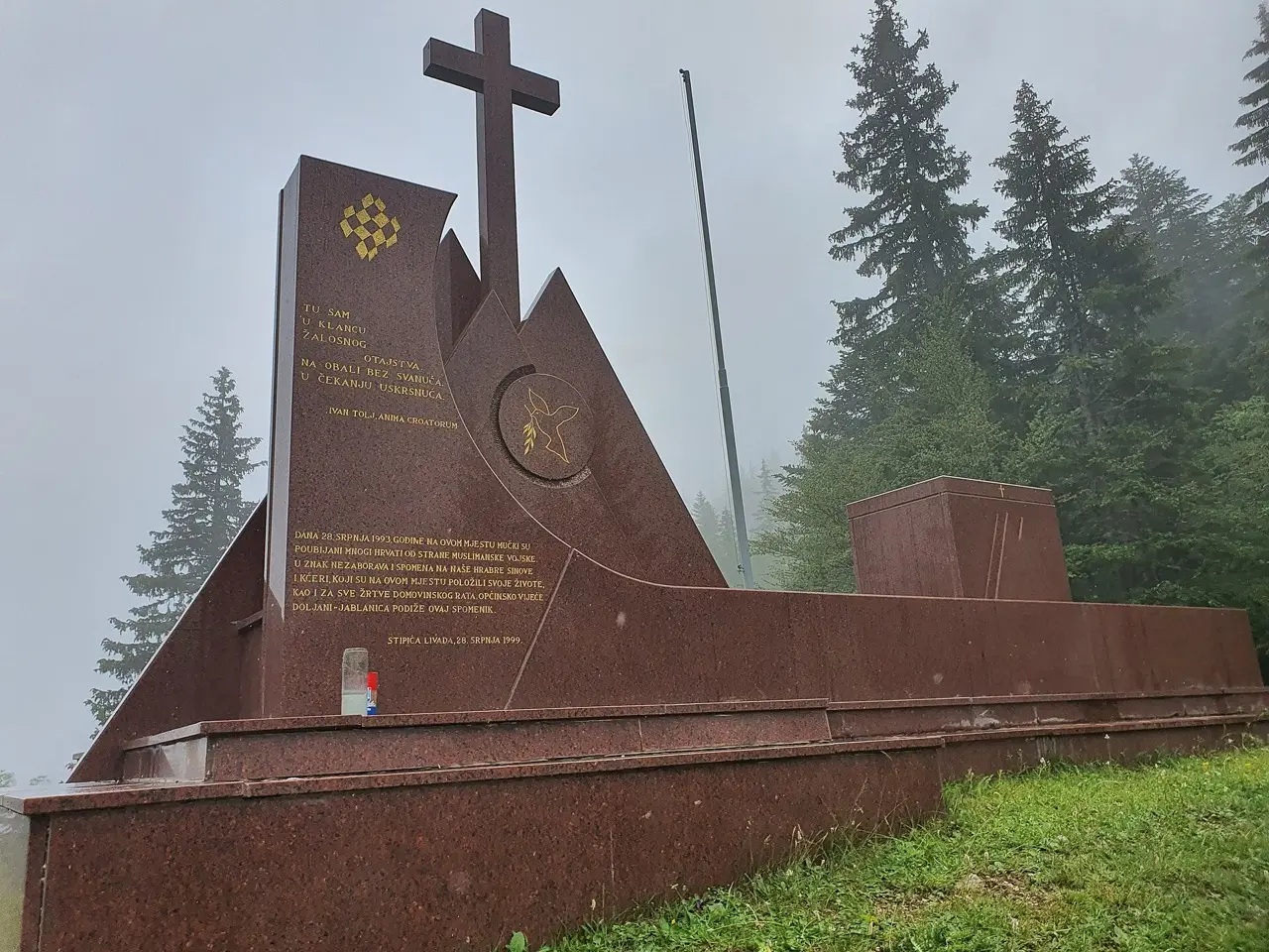
The forest reserve around Masna Luka holds a stand of Bosnian pine (Pinus heldreichii) that the Visit Blidinje brochure calls the largest in Europe - pale bark, high light, a smell that stays in the car on the way down. Also here, at 1,204 m, stands the Franciscan house of prayer: the church of St Elijah with its bell tower (2005), the house itself (2015) and a gallery of Franciscan art, with programmes running through the year. Treat it as a living place of worship, not a photo prop.
Optional paid programmes published on the park site (prices as listed in August 2026): a guided tourist circuit of the main sights for 100 KM (guide included - the listing doesn’t say whether that is per person or per group, so ask when you book); mountain-tour arrangements at 200 KM total with a licensed mountain guide (food, transfer and insurance extra; optional accident cover 1.50 KM per person); a village household visit at 20 KM per adult (kids 3-12 half price). Those are packages, not a ticket to enter the landscape.
Hajdučka vrata and the serious walks
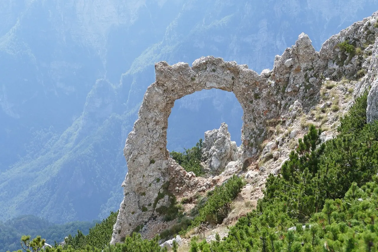
The postcard of Bosnian hiking is Hajdučka vrata, a natural limestone arch on Čvrsnica at around 2,000 m, protected as a geomorphological monument since 1985. Getting there is a proper mountain day: the standard route starts on the plateau side at Vitlenica (1,470 m), about four hours one way, 16.5 km there and back with 700 m of climb, well marked. The Grabovica canyon approach starts near 250 m and is the hard way, not the normal one. Either way it is not a ten-minute stroll from the lake car park. If that’s your goal, read our hiking in Bosnia guide first and leave early with water, offline maps and the landmine rule: stay on marked trails.
For a day trip from Mostar without committing to a summit, stick to the polje: lake shore, stećci, Masna Luka meadows, maybe Risovac for a coffee near the small ski base. The ski infrastructure itself is commercial and seasonal, and lift prices are set locally rather than published by the park - ask at Risovac when you’re there in winter.
Getting there: Mostar, Jablanica, then up
From Mostar the clean line is north on the M-17 up the Neretva canyon. You pass the mouth of Diva Grabovica (a separate canyon day if you’re a hiker), reach the town of Jablanica, then climb west on the M-17.5 toward Doljani and the plateau - signage and road reports use that number, not the older R419 the park’s own geography page still prints. The section is currently open to vehicles up to 3.5 t only, so a campervan needs a different way up. The park’s own “how to reach us” list also names approaches via Goranci and Rosne Poljane, plus Posušje / Rakitno from the west and Tomislavgrad from the north.
Routing tools put the western Siroki Brijeg - Rakitno line at about 70 km and 80-90 minutes; the Jablanica climb described here measures ~85 km and 1 h 20 to 1 h 45 - the same band our wild west Herzegovina route uses. Jablanica itself is the nearest real town - fuel, cash, roast-lamb roadside stops - and the last place you should assume a card machine will work before the lodges thin out. There is no useful bus to the lake or Masna Luka; this is why a hire car pays for itself on the same day you’d otherwise spend on a southbound waterfall coach. Our car rental in Bosnia guide covers deposits and what to check before you leave town.
For the wider mountain-west loop - Blidinje plus the Livno wild horses and Buško lake - follow the wild west Herzegovina route and give it two days. Blidinje alone works as a single Mostar day if you leave by mid-morning and don’t try to bolt on Kravice the same afternoon.
When to go, and how long to stay
May to October is the realistic window for a casual visit. Snow sits late on the Čvrsnica tops; winter access is for people who already understand mountain roads and the Risovac ski season. Summer middays on the polje are bright and windy rather than oven-hot - the relief after Mostar is the whole appeal. Our best time to visit Bosnia calendar puts the wider country in context.
A half-day covers lake + stećci + a coffee at Risovac or Masna Luka. A full day adds meadow walks and a slower return via a different descent if you came up through Jablanica. An overnight on the plateau is the version locals quietly prefer: dawn light on the water, empty roads, and no race back for dinner on the Old Bridge. Beds are limited - book ahead in July and August.
Pairing tip if you’re building a Mostar base week: keep Blidinje for a clear-sky day and save the wetland boat at Hutovo Blato for a different outing. One is highland limestone; the other is reed channels and birds. Both beat doing Blagaj twice. For how they sit among other outings, see day trips from Mostar.
Leave the south for another afternoon
If your Herzegovina plan so far is only Ottoman towns and waterfall selfies, Blidinje is the corrective. It won’t feed you a checklist of ticket booths. It will drop the temperature, put a UNESCO stećci field under big sky, and remind you that Mostar’s hinterland goes up as well as down the valley. Take cash in convertible marks, take a layer, take the car - and leave enough daylight that you’re not learning the M-17.5 hairpins after dark.
Photos
On the map
The map loads on click - to keep the page lightweight.
The map didn’t load. Check your connection and refresh the page.
Admission and opening hours
- Admission price
- No entry ticket for the landscape itself appears anywhere in the park visitor information published by the park association (parkprirodeblidinje.ba, "Korisne informacije"), so plan on free access and confirm on site. Optional paid programmes via Visit Blidinje / park partners: organised tourist circuit 100 KM (guide included; the listing does not say whether that is per person or per group, unlike the neighbouring products - ask when you book); mountain-tour arrangements 200 KM total (licensed mountain guide; food, transfer and accident insurance not included; optional accident insurance 1.50 KM per person); village household visit 20 KM per adult (children 3-12 half price, under 3 free; groups 4-10). Ski-centre tickets are separate commercial prices - confirm on site. Cash in KM is safest.
- Opening hours
- The plateau is open year-round as a landscape; lodges, the Masna Luka visitor hub and seasonal ski operations keep their own hours. Phone Visit Blidinje on +387 63 428 308 or email info@visit-blidinje.com before you count on a guide, a meal or winter access.
Parking at hospitality sites and the ski centre is free according to the park association brochure; there is no public paid car park with cameras. Bring layers - 1,180 m feels nothing like Mostar in July.
Details checked: August 21, 2026
Distance
- Sarajevo ≈115 km · ~1 h 55 - 2 h 15 by car depending on route and stops Routing estimate ~110-120 km / ~1 h 55 - 2 h 15 (OSRM measured 1 h 54, checked 2026-08-21), not an operator timetable. Via Konjic and Jablanica on the M-17, then the plateau climb. Sensible as a stop on a westbound mountain day rather than a short hop from the capital.
- Mostar ≈85 km · ~1 h 20 - 1 h 45 by car depending on route and stops ~85 km via the Jablanica climb described below; the western Siroki Brijeg - Rakitno line is ~70 km. North on the M-17 up the Neretva toward Jablanica, then climb on the M-17.5 toward Doljani and the plateau - that road is open to vehicles up to 3.5 t only. The alternate approach via Goranci and Rosulje is macadam, not asphalt. No bus serves the lake or Masna Luka usefully - you need a car or a prebooked driver.
Read also

What to see · 15 min read
Via Dinarica Bosnia: Huts, Stages & Logistics
Verified · September 12, 2026Plan the Via Dinarica White Trail in Bosnia: 12 stages, 334 km, hut booking, trailheads, closures and three workable section packages.

What to see · 10 min read
Jablanica: Neretva Bridge & Roast Lamb Stop
Verified · September 4, 2026Jablanica on the Sarajevo-Mostar road: Battle for the Wounded museum (5 KM), the 1943 bridge, roast lamb lunch. Hours, parking, how long to stop.

What to see · 8 min read
Prokoško Lake: Shepherd Huts High Above Fojnica
Verified · September 3, 2026Prokoško on Vranica at 1,636 m: katuni, gate prices for foreigners, no swimming, and the 2026 asphalt climb from Fojnica.

What to see · 11 min read
Franz Ferdinand's Sarajevo: Latin Bridge & 1914 Site
Verified · August 29, 2026The Latin Bridge corner in Sarajevo where Franz Ferdinand was shot in 1914: what happened, the Museum of Sarajevo 1878-1918 inside, hours and tickets.